After years of conflict, Southern Sudan overwhelmingly opted to secede from the country’s north. Many challenges lie ahead as the newly independent state negotiates the rocky path towards independence. We believe that access to high-quality, up-to-date and locally relevant maps will assist humanitarian organizations working in the region.
We are encouraging users to add their local knowledge to this mapping effort through a campaign to
build a better map of Sudan. Recent satellite imagery is key to building up-to-date maps, and we are continuously acquiring fresh and historical imagery of Sudan. Our latest imagery update is now live on
Google Map Maker, Google Earth, and Google Maps, with nearly fifty percent of the
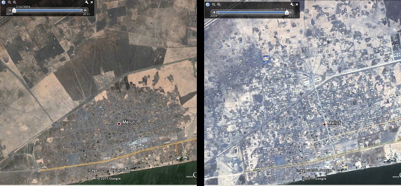
UN priority areas over Southern Sudan covered with high resolution imagery. Thanks to our satellite partner GeoEye, we will continue to acquire and publish high resolution imagery of the remaining UN priority areas, as well as to refresh areas that we have previously covered as the need arises. This new imagery, such as the one over Melut, will directly benefit the many organizations working in Sudan and ultimately support the building of a solid basemap of Sudan to achieve long-term socioeconomic objectives.

Town of Melut (before 2/16/2004, after 1/30/2011). In Melut, there is a humanitarian hub where many services are delivered to at risk populations, including food, water, health care, education, and more. Given the varying needs of each of these services, maps can provide a variety of planning benefits for expansion, staff safety, and emergency procedures.
Google is also contributing to various humanitarian efforts, including the
Satellite Sentinel project, by helping to build an active and self-sustained Sudanese mapping community — locally and among the Sudanese
diaspora. This community will help improve maps of Sudan by using
Google Map Maker, a product that combines the power of mapping with community engagement.
Dedicated mappers have started building the foundation for a Sudan mapping community, resulting in high quality maps of Sudan. But this is a long term process that requires deep commitment from various stakeholders and community groups. To join the Sudan mapping efforts, and offer feedback, please join our
Sudan community mailing list or visit our
team site.