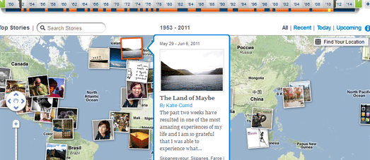
They Draw & Travel – World Map
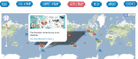
They Draw & Travel is a collection of wonderful user submitted hand drawn maps.
The World Map lets you browse the maps submitted to They Draw & Travel on Google Maps. You can click on any of the map markers and view the hand drawn map submitted for that location.
One Day on Earth
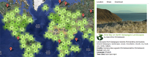
On 10.10.10 One Day on Earth asked people around the world to create a video of their world. The goal of the project was to “create an open shareable archive and documentary film of the world on 10/10/10.”
You can browse and watch the thousands of videos that were contributed around the world on this Google Map.
#rorschmap
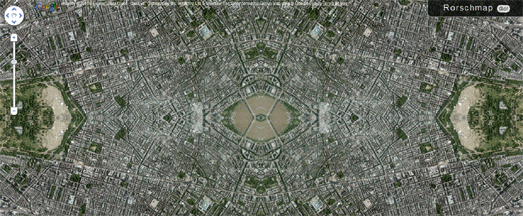
I only found this map yesterday and it has already become a firm favourite.
#rorschmap uses the Google Maps API to create a kaleidoscope for any location on the Earth. Essentially the application displays the Google Maps satellite view of a location and, using the same principle of multiple reflection that you find in kaleidoscopes, creates an animated Rorschach test effect.
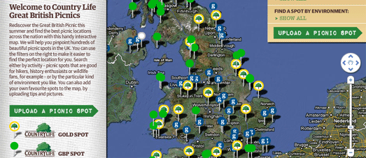
The Guardian newspaper is increasingly working with partners to produce useful Google Map based guides. The newspaper are collaborating with lastminute.com to create their City Guides. They have also worked with Enjoy England to create a Google Map based guide to great destinations in the UK.
The Guardian has now partnered with Country Life Butter to create a Google Maps guide to great picnic spots in the UK.
The map helps you search for a picnic spot by activity, for example spots that are good for hikers, photographers or wildlife fans. You can also search by environment, such as by beach, riverside or country park.
If you have a favourite picnic spot of your own you can add it to the map.
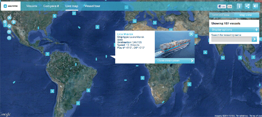
This Google Map allows you to track in real-time the the huge shipping containers of Maersk as they travel around the world.
The position of the ships are displayed live on this Google Map. You can click on any of the ship map markers to view a photograph of the ship and read further details, such as the ship’s destination and current speed.
This map presumably uses the Automatic Identification System (AIS), an automated tracking system used on ships to plot real-time positions.
Integrate Google Maps and Flickr into a Real-Time App
.net magazine has published a great tutorial on how to create a real-time animated Flickr map. The tutorial was written by James Christian and Ben Gannaway the creators of the excellent Net-a-Porter Live Google Map.
The tutorial explains how to create a Google Map that animates in near real-time through images posted on Flickr. The tutorial includes how to work with the Flickr API and how to customise the look of your map.
Alongside the tutorial is a demo map and a link to download the full source code.
Yellow Pages in Canada has released a useful application to help two or more people find the best place to meet.
To find a place to meet you need to enter your address and the address of the person you plan to meet. You can then select the type of venue where you wish to meet, for example a restaurant, a bar or a cafe.
Rendezview will then create a Google Map showing you the most convenient venues that you could meet (based on your selected preferences), roughly half-way between the two locations.
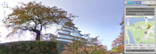
Daniel O’Grady’s excellent Japanese Castle Explorer has been updated to take advantage of all the new wonderful Street View imagery available for Japan.
This year the Street View trike has been very busy in Japan capturing a lot of beautiful new off-road imagery, particular in the grounds of some of Japan’s castles.
The Japanese Castle Explorer is a great map that shows the locations of Japan’s most famous (and plenty of lesser known) castles. The map allows you to view Japan’s castles in Google Maps satellite view. Now it is also possible, where available, to view the castles in Street View.
The map is available in English and Japanese versions. You can view an example of the Street View at Himeji Castle (use the link to ‘Other Castle Panoramas’ in the sidebar to navigate to view other castles in Street View).
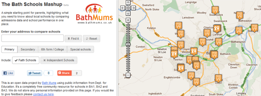
The Bath Schools Map is designed to help parents choosing schools in Bath, in the UK, by displaying local schools and admissions and performance data on Google Maps.
In Bath parents are only allowed to indicate 3 schools as a preference for their children. Using the map it is possible to find the nearest ten schools and compare their academic mini-league tables on a range of metrics with a sidebar. This helps parents make school choices from a broad base of information rather than gearing towards a single metric.
GeoBus
Geobus is a nice little app that can find the nearest bus-stops for any location in the UK. Just enter a postcode or use the ‘locate me’ button and the nearest bus-stops to your current location will be displayed on a Google Map.
The application was developed as part of the recent Young Rewired State initiative.
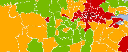
The Guardian has used Fusion Tables to map the latest Health Profiles data from the Department of Health and the Public Health Observatories.
Using the Google Map it is possible to compare a number of health indicators for regions in the UK. For example, it is possible to view child obesity throughout the UK or view where the most people die from smoking.
There are still quite a lot of gaps in Street View’s coverage around the world. Luckily a number of other providers have created their own Google Maps based Street View applications to try and plug these gaps.
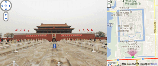
In China City8 have created extensive interactive 360 degree panoramas in 45 of the country’s biggest cities.
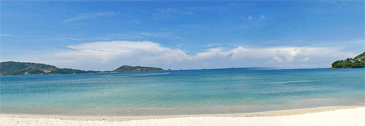
As well as providing Street View type imagery in the USA, Canada, Singapore and Sweden Mapjack has also ventured where Google Street View has so far feared to tread. MapJack has great coverage in Malaysia, Thailand and Puerto Rico.
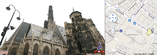
Norc has great coverage in central and eastern Europe, including in Poland and Austria, where Google’s Street View cars have yet to drive.
via:goglemapsmania