App Engine 1.5.2 SDK Released


As the summer heat descends on the Northern Hemisphere we thought we’d release our newest App Engine version with some changes that are sure to keep you playing around in the cool, air-conditioned indoors (hey, you don’t want your computer to overheat, right?).

Production Changes

  • Adjustable Scheduler Parameters – As we previously discussed, we are introducing two scheduler knobs (okay, they actually look like sliders) that will allow you to control some of the parameters that influence how many Instances run your application. Today you will be able to set the minimum pending latency and maximum number of idle instances for your application.

Datastore Changes

  • Advanced Query Planning – We are removing the need for exploding indexes and reducing the custom index requirements for many queries. The SDK will suggest better indexes in several cases and an upcoming article will describe what further optimizations are possible.
  • Namespaced Datastore Stats – Now, in addition to getting overall datastore stats, we are providing a new option to query datastore stats per namespace.

Task Queue Changes

  • New Task Queue details page – We’ve revamped the Task Queue details page in the Administration Console to provide more information about the tasks being run. You can now see the headers included in the enqueued task, the payload, and information from previous task runs.
  • 1MB Pull Task Size – It’s our belief that there is only one way for size limits to go – and that’s up! So with this release we’ve increased the size for pull tasks to 1MB.
  • Pull queue lease modification – We’ve introduced a new method for Pull Queues that allows you to extend the lease on existing tasks if the initial lease on the task was insufficient.

Lastly, we have some exciting news related to the experimental Go runtime. While it still remains experimental, starting with 1.5.2, all HRD apps will have access to the Go runtime in production.

As always, there are also some small features and bug fixes, the full list of which can be found in our release notes (Python, Java). We look forward to your feedback and questions in our forum.
Bing Maps with a new user interface


Over the past few months, we’ve been testing some enhancements to the Bing Maps interface that we’re excited to now make available for everyone. The most apparent changes are to our task and navigation controls, where—based on your feedback—we’ve made it easier to find the most common actions to complete your task at hand.

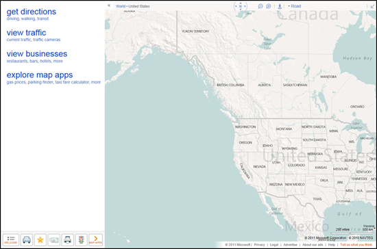
For reference, here’s the previous design (pay particular attention to the top and bottom of the page):


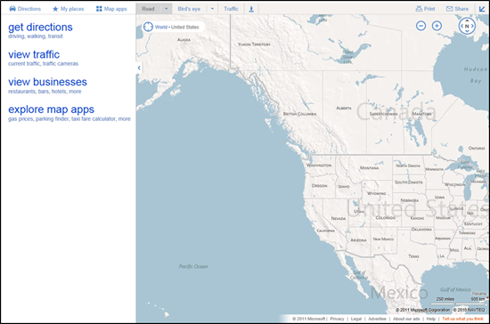
Here’s the refreshed version:


We’ve consolidated actions that were previously scattered throughout the page, and concentrated them along the top, where you expect to find them. We’ve included text labels for most of the buttons. And, most importantly, we’ve focused on making the controls accessible while still allowing the map to be the focus of the page.

These improvements are being rolled out to all of our international sites with appropriate market-specific functionality. For example, Bing Maps users in the UK will still have access to the London Street Map and Ordnance Survey styles, along with our standard Road map, via the vector style drop-down. The public transport overlay, showing tube, DLR, and tram networks, is also readily available from the navigation bar when the map is centered over the greater London area.]


You’ve told us you love our unique Bird’s eye 45-degree perspective, viewable from all four compass directions, as well as our high resolution Aerial imagery (see the recent blog post on the Global Ortho Project for more details). As a result, we’ve improved access to these imagery types by making them directly accessible from the top of the navigation bar. At the same time, you can now more easily switch between various road and imagery styles with a single click. You also have the option to view either of the imagery styles with or without labels, depending on your preference.


TIP: Automatically center the map on your current location

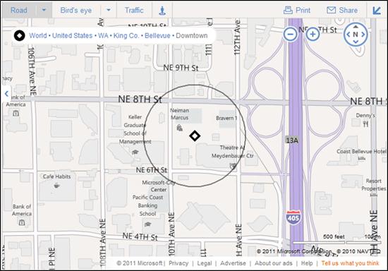
If you’re visiting Bing Maps with a browser that supports the W3C Geolocation API, you’ll find a new button (calledlocate me) available to the left of the breadcrumb that, when clicked, will center the map on your current location as reported by your browser.


You’ll receive the highest accuracy results—including a pin and approximate radius—when using a computer with WiFi enabled. You can turn off the pin by clicking the button again. (Note: all browsers will prompt you to share your location after you click the locate me button; if you choose not to allow access, Bing Maps will be unable to center the map on your location.)


We hope you find these changes make Bing Maps simpler and more efficient to use as you focus on completing your map-focused tasks!