Placemark Clustering Investigation

First of all I’ll start by making a point by considering a couple of examples of the development of everyday technologies:

College Dropout changes Computer text: The text you’re reading on screen would be very different were it not for the actions of a student dropout. Steve Jobs dropped out of Reed college but, because it interested him, still attended a class in calligraphy. The techniques he learnt, about elegant letter spacing and formats, were later applied to the Mac and from there were copied by windows. We’ve all benefited from Steve’s nerdy love of text.

Spam Email didn’t have to exist: Email was invented early in the history of the internet but because everyone then knew each other by name, no one bothered to produce code in email programs that checked the ID of senders. We all suffer because this didn’t happen, the internet is swamped by spam email traffic that could have been avoided. Google Wave was an attempt to get us all off email to avoid this sort of problem, it didn’t take off despite having the promotional weight of Google behind it.

Get Technology right early on: My point is that its incredibly important to try and get early technology right otherwise you may never be able to correct it. One of the issues I see like this in web mapping is the clustering of points, if we get it wrong now we may never be able to undo it and we will end up using sub optimal visualisation techniques just because we’ve always done it.

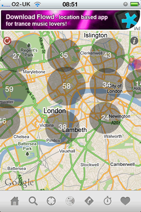
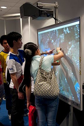
Clustering Placemarks: Previously I’ve written about the problem, placemarks need clustering because at a certain density of points it is becomes impossible to pick individual points out. IMHO some of the ways of visualising these are poorly designed e.g. clustering placemarks into ‘blobs’ with numbers.

It may be that numbered blobs work as a way of clustering placemarks – maybe users immediatly get the concept of a large blob being a cluster and that outweighs other problems I’ve identified. But what worries me is that this technique is all over the place in web maps and no one has actually done any user testing to show that its effective.

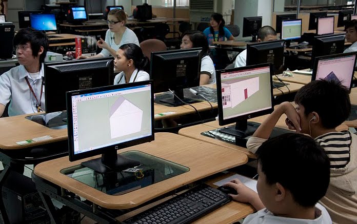
Enter my new MSc student Craig who’s doing his project on this map visualisation. By doing a series of user tests we hope to answer the questions:

* Does blob clustering work compared with other techniques?
* If not, can we adapt it so it does?

Wider Point: This isn’t the only example of a technique that is being widely used in web maps without being user tested (anyone for 3D thematic maps?) so I think Craig’s work will also be important in promoting the more general idea that we need usability testing in web maps. At the moment I think web programmers are applying these untested techniques because they think the look flash and/or they are easy to apply because the software needed is readily available.

The 3D Philippines Initiative

We recently made a trip to Manila to help out with the 3D Philippines Initiative started by COMMDAP. The initiative’s goal is to create an entirely 3D Philippines using Google SketchUp and Google Earth so that information can be shared and experienced in a richer way than with just a basic map. It was an action-packed three-day schedule.

The first event was a general geo-modeling presentation for students and teachers at the University of Makati, which was part of the school’s “Technology Week”. The second event was a presentation to the Google Technology Users Group of the Philippines on geo-modeling and becoming a Geo 3D developer.

Me (Nicole) onstage presenting the basics of geo-modeling
Bruce Polderman answering questions about certification for Geo 3D developers

Next, we held two full-day workshops at the university: one for educators and trainers and one for students. These workshops focused on developing basic modeling skills by means of an introduction to SketchUp, but we taught aspects of photography, photo editing, and other techniques specific to geo-modeling as well.

Teachers’ workshop at the University of Makati
Group photo with the teachers
Students’ workshop at the University of Makati
Group photo with the students

Concurrently, COMDDAP was hosting the Manila Expo 2010. There, they had a designated area where visitors could learn about Google Earth and explore the virtual globe both on a standard computer AND on a super-cool interactive touch-sensitive projection white board.

Now THAT’S a touch screen!

Take a look at this photo album for more pictures of our visit to the Philippines.

FME Webinar: Practical Techniques for Loading Data Into SQL Server

Ed Katibah says that there will be a Webinar next week on loading data into SQL Server Spatial.

One of the most often asked questions about SQL Server Spatial is “How do I load data into the spatial types?”. Safe Software has long provided solutions for this dilemma with their excellent ETL tool, Feature Manipulation Engine (FME).  On December 14th, Safe will be presenting an FME Webinar entitled “Practical Techniques for Loading Data into SQL Server”.

Sounds interesting as Esri doesn’t really give you the right tools to load data into SQL Server Spatial like FME does.