Geo Sitemap Generator’s New Features

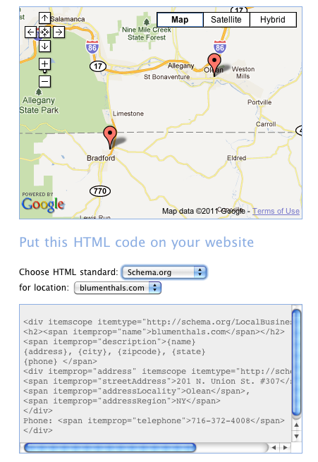
The “grand daddy” of geo sitemap generators has recently included some new features. Geo Sitemap Generator, first released by Arjan Snaterse in 2009, has added the ability to generate either a schema.org file or a microformatted file of your contact information. In addition to the features in the geo sitemap tool that I reviewed last week, Geo Sitemap Generator supports multiple locations and now provides a preview of the KML file locations on a Map.

The benefits of multiple locations are obvious if you need them. The benefits of the map preview are not so obvious but very real. KML files require a mapping API to generate the lat long info included in the file. Sometimes the information from the API, even from the same map provider, renders the location differently than reality or differently than the public mapping program. It has always been a good idea to check the KML file’s lat-long accuracy by loading it into something like Google Earth to be sure that it pins the locations correctly. Now Geo Sitemap Generator previews the pins on a Map for you when you go to download your files saving you a necessary step.

.
Google Places Updates

There have been two updates to the Places Quality Guidelines over the past two weeks. On July 21st, with the rollout of the new Places Page look, Google added this paragraph (bold added by me):

You cannot create Places listings for stores which you do not own, but which stock your products. Instead, consider asking the store owner to update their own Places listing with a custom attribute specifying brands or products they stock, including yours. While this data may not appear on the Place page, this information continues to help our system understand more about your business and ensure your organic listings appears and ranks appropriately on Google and Google Maps when potential customers perform searches related to your business.

This is a clear indication that while not displaying the information in the Additional details area of the Places listing they are in fact using the information for relevance and rank in retrieval of the listings and you want to still fill in the extra information.

Google added a paragraph to the Quality Guidelines allowing stores within other stores to explicitly note their relationship with the mall or container store:

Some businesses may be located within a mall or a container store, which is a store that contains another business. If your business is within a container store or mall, and you’d like to include this information in your listing, specify the container store in parentheses in the business name field. For example, Starbucks (inside Safeway).

The NSW Interactive Atlas

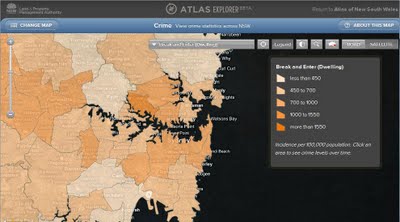
The Atlas of New South Wales is an initiative of the Land and Property Management Authority and it was created with the objective of providing detailed statistics across a range of topics to educational institutions and the broader community. It is built with Bing Map so, provides very familiar to many, simple and intuitive interface to government information.


All the information is presented as a series of thematic map overlays in four categories:

  • People (eg. population, health, housing, religion, indigenous population, indexes of relative advantage/disadvantage, crime);
  • Economy (eg. labour force, taxation and revenue, and production of fruit and vegetables, oils and grins, and livestock);
  • History (eg. information on settlement, State elections and boarders); and
  • Environment (including vegetation, geology and soils, and locations of national parks).

Users have a choice between satellite image or roads map as a base layer and can adjust transparency level of thematic overlays. Each overlay is accompanied by a comprehensive legend, explaining the meaning of presented data. A click on individual region brings up a pop-up window with information about the region, presented as charts and gauges.


The Atlas of New South Wales is quite responsive considering the amount of data that is required to present thematic overlays. It would benefit though from a bit more legible charts and access to source data in a tabular format and/ or for download. Overall, the application is well built and very simple to navigate through.