We mentioned a great map from Hidenori Watanave that showed various information from Japan including flooding regions, power plant locations and other items.
They’ve just released a new map, and I think it’s even more impressive! They’re calling it the Photo-Overlays of “The Aftermath in Japan” from New York Times , which places 30 different images from the New York Times as photo overlays in Google Earth. The photos were selected from this feature on the NYT, “The Big Picture” at Boston.com, Oregon Live, and more are being added all the time. However, as you can see in the image below, they’ve taken their time to line up the photos very carefully and the result is quite immersive:
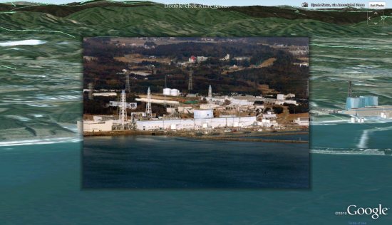
It also has a series of tools at the top of the screen to allow you to view some of the GeoEye imagery, turn on/off 3D buildings, view imagery from different dates, and to simply fly back out to the overview (quite useful while viewing an image).
While this is a fairly simple map to use, it’s been well-polished and is a great way to view the photos from this disaster.
Also of note is a new map from SigActs that shows before and after imagery in Sendai. The interface is quite similar to the one from AnotherEarth that we showed you a few weeks ago, but this has been updated to show some great before/after shots.
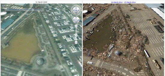
Browsing around in there really shows the devastation and how much has changed in the area since the disaster struck.