The Bing Maps Windows Presentation Foundation Control v1

Back in August, was announced the Beta for our Bing Maps WPF control. The uptake in the Microsoft Developer Community has been stellar and the feedback – immensely helpful. As a result and as promised to those across the Microsoft Developer Network, we’re officially releasing The Bing Maps Windows Presentation Foundation Control, Version 1.

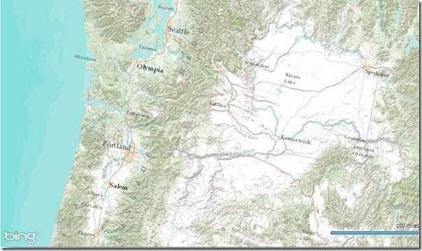
Bing Maps WPF Control with an ESRI Topographic Map Tile Overlay

The control was built atop of the beta, so we still have all of the touch enabled greatness for Surface v 2’s Pixel Sense, inertia and full rotation. We’ve kept most of the classes, methods and properties in place from the beta – requiring little work to install and register v1. And, per community feedback on the Bing Maps MSDN Forums we added the following features (and fixed a few bugs):

  1. Support for tile layers – you can now overlay your own tile layers atop the map control.
  2. Turning off the base tile layer – this is useful for when you don’t need/want to use our base map tiles and instead would prefer to use your own without overlaying them atop of ours. The control won’t request the tiles which reduces downloads and improves rendering performance.
  3. SSL Support – since many of you are using the WPF control in secure applications, you can now make tile and service request over SSL without issue.
  4. Hiding the scale bar – if you don’t want a scale bar (perhaps your map is small and the scale bar clutters the map) you can turn it off. In fact, the only elements you can’t turn off are the Bing logo and the copyrights.
  5. New copyright service – provides accurate copyright for our data vendors.
  6. Additional inertia – inertia is now enabled for the mouse and is on by default for touch.
  7. Miscellaneous bug fixes – thanks for the feedback on the MSDN Forums, the Bing Maps Blog, e-mail and Twitter. Good finds people.

I have to give it up for my (small) crack team of people involved in the making of the WPF Control. This was one of those 10% projects that we all really had a passion to get done because it was the right thing to do for the Microsoft Developer Community. So, we found the time, slipped the release a month (for quality) and, as the guys over in Surface said, “just got it done.” Our internal motto kept stoking the fire to push this bad boy out the door…”WPF, FTW!”

Now, download the Bing Maps WPF Control, build a killer app and make us proud.
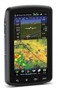
The Garmin aera 796 and 795 -Navigators with 3D Vision


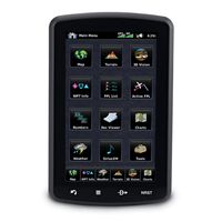
Garmin announced its newest flagship aviation portable GPS series, the aera 796 and aera 795. These new devices have all of the great features you have come to know and love from a Garmin aviation portable like a 5 Hz GPS receiver, the patented Panel Page and XM weather integration, plus the aera 796/795 is enhanced with even more features that make it Garmin’s most capable aviation portable yet! Some new additions include a touchscreen user interface, pilot-selectable screen orientation and 3D Vision.

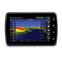
What is 3D Vision?
3D vision is a unique 3D view of the surroundings outside the aircraft. It uses GPS position and the terrain-alerting database to recreate a behind-the-aircraft perspective view of the topographic landscape. The resulting virtual reality display offers pilots a supplemental 3D depiction of land and water features including terrain, obstacles, runways and airport signposts all shown in relative proximity to the aircraft. With the flick of a finger, the 3D view can be rotated around the aircraft to easily view the surrounding terrain.

A path to a paperless cockpit

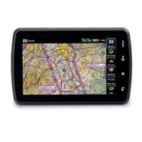
Because of the comprehensive offering of electronic charts, the aera 796 may be qualified for use as either a Class I or Class II Electronic Flight Bag (EFB). Geo-referenced IFR Enroute charts and VFR Sectional charts come pre-loaded, and the aera 796  also includes geo-referenced Garmin FliteCharts®, an electronic version of the AeroNav U.S. Terminal Procedures Publication. For pilots who prefer Jeppesen charts and diagrams, Garmin also offers a ChartView enablement option. Garmin ChartView utilizes Jeppesen’s extensive library to provide global charting capabilities. More “paperless” offerings include a digital document viewer, scratch pad and pre-loaded geo-referenced AeroNav IFR and VFR enroute charts.

Plus a large touchscreen display
The large icons on the high-resolution 7-inch touchscreen display make this device so easy to use. Using  your finger, you can quickly pan across the map, pinch zoom and quickly access information. The icons along the bottom row of the display are even customizable, so you can pick your favorite features and anchor them at the bottom of the display for even faster access.

The aera 796/795 will be on display and available for purchase next week at the AOPA Aviation Summit in Hartford, Connecticut. Come by and visit us! If you can’t make it to the show, but want to get your hands one one, visit your local Garmin authorized dealer.

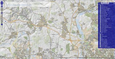
OpenLayers-based slippy map

Facilmap.org Beta is an OpenLayers-based slippy map that aims to combine useful geographical information, renderings and tools of different projects into one reusable and extend-able map.

Facilmap.org Beta

Some available layers (there are more)

  • Mapnik
  • Osmarender
  • OpenCycleMap
  • Minutely Mapnik
  • OpenStreetBrowser
  • Hike & Bike Map
  • OpenPisteMap
  • ÖPNV-Karte
  • MapSurfer Roads
  • MapSurfer Topographic
  • Ordnance Survey OS Streetview (UK only)

More information on this project:
http://wiki.openstreetmap.org/wiki/FacilMap

Source and Credit to Candid Dauth:
http://www.openstreetmap.org/user/Candid%20Dauth/diary/12723

Map
http://beta.facilmap.org