The History of U.S. Road Maps

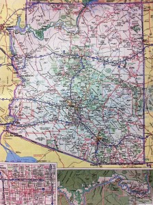
Somewhere on the back seat of the car—I think it’s under a history of Beloit College’s radio station and a scattering of brochures promoting tourist attractions I’ll never visit—is a “Deluxe Edition” 50-state Rand McNally road atlas. Chances are good that at some point you’ve pored over the road atlas’s big pages, with their pale-purple state borders and pastel parks, trying to plot some long-ago trip to the beach or the mountains. Or maybe you’ve tried to use one of those frustratingly small inset city maps (“Tucson” or “Central Phoenix”) to get from your Best Western to that Mexican restaurant the desk clerk described.

Chances are also good, though, that nowadays you use the road atlas a lot less, if at all. As of last night, I’ve driven 3,402 miles since this road trip started, and the atlas hasn’t been out of the back seat once. Instead I’ve trusted Google’s maps and algorithms and my iPhone, which has spent a lot of the trip balanced on my right knee. Aside from one Holiday Inn Express that Google misplaced, they’ve been a great pair.

In a way, I miss relying on the atlas (though not enough, apparently, to open it). A full-page map of whatever state you’re in, or are planning to visit, offers context that Google Maps does not, not even on a full-size screen. So it was fun to run into James Akerman, director of the Center for the History of Cartography at the Newberry Library in Chicago, at a bed-and-breakfast a block from Grinnell College. He was in town to give a lecture at the college, and he took time out to talk to me about the history of road maps.

Rand McNally, Mr. Akerman said, got started as a Chicago printing company that did a lot of work for railroads—”that’s how they got involved in cartography.” Not long after the dawn of the automobile age, the company also began producing road maps for oil companies, which gave them to customers as a way of encouraging brand loyalty. Rand McNally’s two big competitors in the road-map business were the General Drafting Company and H.M. Gousha Company, Mr. Akerman said. The maps were updated annually and were “very accurate,” he added.

All three companies had recognizable house styles, although their maps were customized for different clients, which also included hotel chains and some tire companies. “Sometimes on the back of the map there was a pictorial guide to the region, with scenic attractions,” Mr. Akerman said, and some of the oil companies even offered travel bureaus that helped customers plan their trips.

By the mid-1960s, he said, some 200 million road maps had been given away. The beginning of the end, though, came when gas prices soared during the energy crisis of the early 1970s. The oil companies started looking for ways to cut costs, and after gas rocketed above $1 a gallon, customers pretty much abandoned whatever brand loyalty they’d had—it had always been a fleeting thing, one gasoline being pretty hard to distinguish from the next. Free maps went the way of give-away drinking glasses and, eventually, full-service gas stations.

The oldest items in the Newberry Library’s collection of auto-oriented cartography include maps produced before the creation of the numbered highway system. Drivers navigated routes with names like the Lincoln Highway and the Dixie Highway; the road that runs through the town of Grinnell was once known as the Roosevelt Highway, Mr. Akerman said. The numbered highways—Route 66, of course, was the most famous—were in turn supplanted by the interstates. As Mr. Akerman put it, the interstates “insulate us from the landscape,” cushioning drivers with blue-signed rest areas and a seemingly endless supply of Golden Arches.
Objects in mirror…

Nearly a year in the making, kernel.org has announced four new machines coming online in November of 2010. This is quite the change in infrastructure, covering two new “heavy lifting machines” and two new backend machines to round out kernel.org’s infrastructure of 12 boxes running worldwide.

As many people know, particularly if you are reading this blog, kernel.org runs the infrastructure that the Linux Kernel community uses to develop and maintain a core piece of the operating system. That said, kernel.org provides a lot more services than just a couple of git repositories and a place to download kernel releases. It hosts the Android source, provides Internet bootable utilities and installers, one of the fastest and most comprehensive mirrors of Linux distros, a plethora of wikis, and the Linux Kernel bugzilla. It also hosts and maintains a variety of other websites that are central to the development of the Linux Kernel or to the greater Linux ecosystem.

The four new machines that have fully come online in November were donated by Google with a generous discount from HP, and they are some impressive pieces of hardware to say the least!

Mirrors1 and Mirrors2, the two machines in the United States that service mirrors.kernel.org, fully replace machines that had been in service for 5 years. The new machines live up to their names of the “heavy lifting machines” (both because they move the most data for kernel.org, but lifting 6-10u worth of equipment is actually quite heavy)! Specs for those are:

Mirrors1:
DL380 G7
2 x E5640 Intel Xeon Processors
144GB DDR3 ECC RAM
2 x MSA70 external drive chassis
2 x P812 Array controllers
66 x 300GB 10K RPM SAS drives

Mirrors2:
DL380 G6
2 x X5550 Intel Xeon Processors
144GB DDR3 ECC RAM
2 x MSA70 external drive chassis
2 x P812 Array controllers
66 x 300GB 10K RPM SAS drives

Each setup uses up 6u of space now, saving us about 4u per-setup over our old equipment, and they give us a lot more storage space and a lot more RAM to be able to handle mirroring for so many people.

We also upgraded the master backend machine for kernel.org, and took our still-awesome previous master backend and turned it into a live spare should anything ever happen to the primary machine. We added a second dynamic web infrastructure box as well, to help host the wikis and things like bugzilla, giving us an active fail over as well as a load balanced system.

With these two additional boxes coming online, kernel.org reached a milestone as we now have a redundant machine for everything currently in our inventory. We’ve been quite successful with the redundancy we have with our frontend facing machines, and now we have that same level of redundancy available to us on our backend machines.

master:
DL380 G6
2 x X5550 Intel Xeon Processors
32G DDR3 ECC RAM
1 x MSA60 external drive chassis
2 x P812 Array controllers
8 x 300G 10K RPM SAS drives
12 x 300G 15K RPM SAS drives

dynamic web box 2:
DL380 G6
2 x X5550 Intel Xeon Processors
32G DDR3 ECC RAM
1 x MSA60 external drive chassis
1 x P812 Array controller
8 x 300G 10K RPM SAS drives

Needless to say we can talk a lot about specs and numbers. But really, a photo is worth a thousand words:


Those are the new backend boxes hosted at OSUOSL.

Our thanks go out to Google and HP for helping make this happen, with special thanks going to
Chris DiBona of Google for making this happen, Shawn Pearce of Google for putting up with with me through all of this, and Bdale Garbee of HP for helping us get the equipment we need and being such a great friend of kernel.org for so many years!

To quote our saying on mirrors.kernel.org, “Objects in mirrors may be closer than they appear!”

New Google Earth Imagery – November 16

As pointed out by GEB readers ‘Munden’ and ‘Steven’, Google has just pushed out some fresh new imagery!

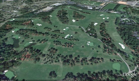
augusta.jpg

As is usually the case, you can use Google Maps to determine for sure whether or not a specific area is fresh. This new imagery isn’t in Google Maps yet, so you can compare Earth vs. Maps to see what’s new; the fresh imagery is already in Google Earth, but the old imagery is still in Google Maps. If you compare the two side-by-side and they’re not identical, that means that you’ve found a freshly updated area in Google Earth!

[UPDATED — 17-November, 3:01pm EST]

  • Argentina: Buenos Aires — thanks ‘Daniel’
  • Austria: Vienna — thanks ‘Joeran’
  • Canada: Saskatchewan — thanks ‘Steven’
  • China: Various areas — thanks ‘Munden’
  • Faroe Islands: — thanks ‘Munden’
  • France: Bretagne — thanks ‘Martin’
  • Indonesia: Southern part of Jakarta — thanks ‘okasbali’
  • Romania: Timisoara — thanks ‘twist3r’
  • Russia: Losino-Petrovsky, Lugovaya, Mendeleyevo, Monino and Povarovo — thanks ‘Munden’
  • United States: Georgia (Augusta), Indiana (Evansville), Louisiana (Baton Rouge), New Jersey (Trenton), North Carolina (Wilmington), South Carolina (Charleston, Columbia), Texas (Fort Hood), Wisconsin (Madison) — thanks ‘Dan’, ‘McMaster_de’, ‘Munden’, ‘Scott’ and ‘Steven’

If you find any other updated areas, please leave a comment and let us know!