The new 3D cities on Google Earth for Android

Explorers of the world, rejoice! There is now a new way to explore the world, right from the palm of your hand. Gone are the days when the only way to get a bird’s eye, 3D view of your favorite metropolitan area was from the window of a penthouse apartment or helicopter. Now you can soar above your favorite cities in 3D, with Google Earth for mobile.


New 3D Imagery

We recently shared a preview of this striking new 3D imagery and starting today, you can take flight yourself with our latest version of Google Earth for Android. An updated version of Google Earth for iOS will be also be available soon.


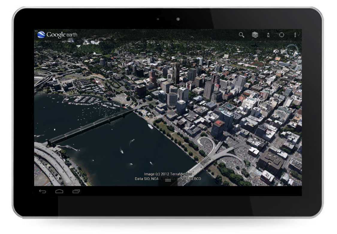
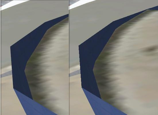
New 3D imagery of Portland, Oregon

Creating this comprehensive 3D experience is possible due to advanced image processing. Using 45-degree aerial imagery, we’re able to automatically recreate entire metropolitan areas in 3D. This means every building (not just the famous landmarks), the terrain, and any surrounding landscape of trees are included to provide a much more accurate and realistic experience.


Get started today by taking a virtual flight over one of our initial 3D imagery cities: Boulder, Boston, Santa Cruz, San Diego, Los Angeles, Long Beach, San Antonio, Charlotte, Tucson, Lawrence, Portland, Tampa, Rome or the San Francisco Bay Area (including the Peninsula and East Bay). We’ll continue to release new 3D imagery for places around the world over the coming months; by the end of the year, we aim to have new 3D coverage for metropolitan areas with a combined population of 300 million people.

Tour Guide

Not sure where to begin? Let the new tour guide help show you the way. We’ve put together short tours of thousands of famous places and historical sites across the globe so it’s easier than ever to discover amazing places. Just pull up the tab at the bottom of the screen to open the tour guide. Each image highlights a tours or place of interest in the area you are looking. Click on an item and you will be flown there. As you fly in and around the sites, snippets from Wikipedia provide additional information about the location. It’s like having a local expert right beside you!


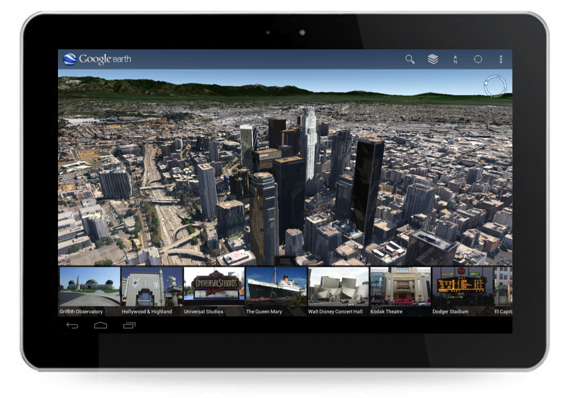
Tour guide showing top destinations around Los Angeles.

We hope this more accurate, comprehensive and realistic 3D representation of the Earth brings out the inner explorer in you. Whether you are visiting familiar grounds or venturing out into the world, Google Earth is there to show you the way.

Speed up Google Earth

Some of you out there are running brand new, amazingly fast machines that can handle anything you throw at it and Google Earth consistently runs well. For the rest of us, though, we need to balance features vs. speed in order to keep things running smoothly.

With that in mind, here are some tips to help Google Earth run more smoothly on your computer.

DirectX vs. OpenGL (Windows only)

On Windows computers, you have a choice to run Google Earth in “DirectX” or “OpenGL” mode. You can change the setting from inside of the [Tools] –> [Options] menu, or start them separately from your main Start menu. There may not be much of a difference, but play with them and see what happens.

Disable some layers/places

If you’re running with a whole bunch of Layers and Places open, try turning a few off. I enjoy keeping the Blue Marble overlay on quite often, along with a handful of other layers (roads, borders, 3D buildings, etc). However, things speed up considerably if I turn all of that off.

3D buildings are one of the biggest performance hogs, simply because they generate a lot of data to be displayed, so turning them off will help quite a bit. On the other hand, if you’re wanting to find ways to improve 3D building performance, then disabling as many other layers as possible is your best move.

Anisotropic Filtering

Anisotropic filtering is one of those cool features in Google Earth that most people don’t understand. In short, it helps keep things sharp when you’re viewing imagery from a low angle. Here is an image from the anisotropic filtering Wikipedia entry, comparing it turned off (on the left) and on (on the right):

Anisotropic_compare.png

You can see that it certainly helps make things look better, but it also costs a bit of performance. Turning it off can help speed things up.

Antialiasing

Anti-aliasing is a technique used to smooth the edges of features in an image. In Google Earth, this is particularly noticeable on 3D models. For example, here is part of the Georgia Aquarium with Google Earth’s Antialiasing set to “medium” on the left and “off” on the right. You can clearly see how much it improves the appearance of the building, though turning it off will help things to run a bit more smoothly. You can turn it off in the main [Tools] –> [Options] menu.

aquarium.jpg

Terrain Quality

The entire globe in Google Earth is covered with a 3D terrain mesh. But adjusting the quality of that mesh, you can improve performance. Simply go to [Tools] –> [Options] and move the Terrain Quality slider further to the left.

Atmosphere

When zoomed out, Google Earth has a cool blue/gray atmosphere surrounding the earth. You can disable it by clicking on [View] –> [Atmosphere].

Water Surface

When Google Earth 5 was released, one of the big new features was the 3D ocean. Part of that new feature includes a realistic looking surface on the ocean. To disable that surface, go to [View] –> [Water Surface].

Cache

Google Earth keeps imagery in two types of caches to help improve performance. The Memory Cache holds imagery in your RAM, and is cleared each time you boot up your computer. The Disk Cache holds imagery on your hard drive for easier access. Incresing those numbers can help your performance. However, if you have a low amount of RAM or are low on hard drive space, you may be better off to decrease them a bit to give your computer a little more to work with.

None of these tips will make a huge difference by themselves, aside from any massive “Place” that you may have enabled, but added up they can make quite a difference. Play with some of the settings and see what happens.

Did Street View capture images of Phillip Garrido…?


You can read Jaycee’s story on Wikipedia (or almost any news site), but the short version is that she was kidnapped in 1991 and wasn’t found for 18 years! Police visited Garrido’s house various times over the years, but never looked in the back yard where Dugard was being held.

Viewing the home in Google Earth (KML
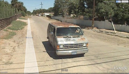
) doesn’t show much, but if you switch to Street View mode you’ll see Garrido pull out of his driveway and follow the Street View car down the road.


garrido.jpg 

To get that close-up shot of him, continue south down Walnut and then west on Bown until you reach Viera Ave. At that stop sign, he gets right up behind the StreetView car as shown above. Of course, there’s a chance that this isn’t Phillip, but it seems quite likely that it is — it’s his van, coming from his house, and it’s a male driving.

There have been a handful of famous people (possibly) spotted in Street View, but this is certainly one of the most high-profile. For other interesting sites in Street View, check out StreetViewFun or the Street View section on Google Earth Hacks.