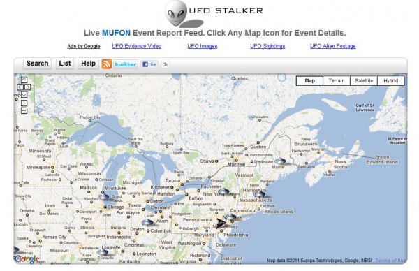
Google Map of UFO evidences

ufostalker.com

“I was outside shovelling snow when I heard a weird sound. That’s when i looked in the air and saw something hovering above my house. It was clearly a UFO because it was too close to be anything else. It was a coppery, golden color with flashing red lights. I felt priviledged that I was witnessing this rare event. Then my dog went around front and the UFO took it up through a beam and dropped it backed down about a half hour later. Weirdly my dog was completely unharmed and shortly after the UFO left leaving a tail as it flew away.”

This is only one of the evidences from this interesting map- site that I found…

Google Maps: Make your map interactive

With a paper map, you can truly make it your own by getting out a pen or a pencil, and adding your own annotations to it. You could circle all the museums that you want to visit, or trace the route that you will take on your road trip.

Maps API applications can now offer users this sort of tactile interactivity using the new Drawing Library. The Drawing Library provides a toolbox which enables users to draw markers, lines, and shapes on the map, much as they would in any drawing application. The tools can be used for collecting annotations from users, or for selecting regions to search or highlight. Applications can listen for events when overlays are added and respond accordingly, such as issuing the search query or saving the annotations to a database.

Shapes on a map, including shapes users have just drawn using drawing tools, can also be made editable so that users can modify or correct them. For example, the user could change the bounds for a geospatial query with the drag of a mouse. The Polyline, Polygon, Circle, and Rectangle classes have a new editable property, which toggles the visibility of control points on these shapes.

For more information on using the drawing library and editable shapes, please refer to the Maps API documentation. The Maps API forum is a great place to discuss these new features, or raise any other Maps API issues that you may have. We hope that these new features will result in even greater interactivity for applications built on top of the Maps API.
Google Maps for Android: Now you can see your rated places and discover new ones directly on the map

Since the My Places tab was released earlier this summer, you’ve been able to view all the places you’ve rated in one manageable list. This list is now being used to personalize your view of Google Maps, enabling you to visualize all the various places you’ve visited, loved, loathed, and might want to check out right on the map.

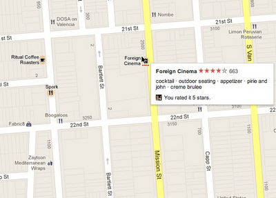
Starting today, business labels for locations you’ve rated with Google Places will be highlighted on the map with your corresponding rating beneath it. Additional places that our system thinks you might enjoy visiting — either to eat, shop, or more — will be highlighted as well. These personalized recommendations are based on the places and ratings you’ve already shared.

Rated Foreign Cinema 5 Stars. Ritual Coffee & Spork are recommended by Google Places
Whereas old paper road maps only became “personalized” when you accidentally folded them the wrong way, spilled a drink on them while driving or physically got out a highlighter to circle locations of interest, we hope this simple and lightweight way of emphasizing the places you’ve shared your opinions about makes Google Maps even more personal, relevant and helpful.

These highlighted map labels are available on the desktop and Google Maps for Android. To get started, sign in with your Google account and either check out a place you’ve rated or contribute more Places ratings.