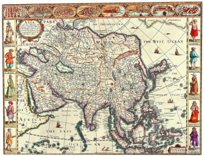
The Art of maps: John Speed: Asia with the Islands adioyning described, the atire of the people, & Townes of importance, all of them newly augmented . . . 1626

Old Maps John Speed Asia with the Islands adioyning described 1626

Asia with the Islands adioyning described, the atire of the people, & Townes of importance, all of them newly augmented . . . 1626

Map Maker: John Speed Place

Date: London / 1676

Coloring: Hand Colored             Size: 20 x 15 inches                Condition: VG

Description:

Striking example of Speed’s map of Asia, decorated with 10 costumed figures and 8 town plans of important early Asian cities (Candy, Goa, Damascus, Jerusalem, Orumus, Bantam, Aden and Macao). Korea is shown as a slender oddly projected Peninsula.

The Great Wall of China is shown, along with and Elephant above the source of the Ganges. A nice simple/naïve Northeast passage is shown, along with a piece of North America and sea monsters in the extreme North Pacific and Southern Indian Sea. The text on the verso presents a fascinating Anglocentric view of Asia in the early 17th Century.
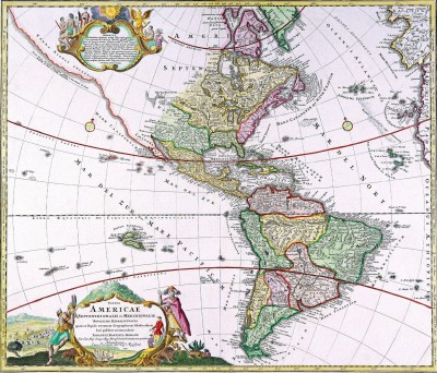
The Art of Maps:Johann Baptiste Homann [California as an Island]

Johann Baptiste Homann - Totius Americae Septentrionalis

Johann Baptiste Homann – Title: Totius Americae Septentrionalis et Meridionalis Novissima Representatio . . . [California as an Island]


Map Maker: Johann Baptiste Homann
Place / Date: Nuremberg / 1710
Coloring: Hand Colored
Size: 22.5 x 19 inches
Condition: VG
Price: $1,800.00

Description:

Striking dark impression of the first edition JB Homann’s map of America, showing California as an Island on the second Sanson model and pre-datingHomann’s privilege.

The Straits of Anian are shown forming a Northwest Passage between California and the mythical Terra Esonis, which forms a nearly continuous land bridge from the Northwest to Asia. The Pays de Moozemleck is shown east of the Straits of Anian. This landmark remains virtually unchanged through all of Homann’s maps of America, despite the transition to a peninsular California, resulting in an odd change from a coastal to an apparently landlocked position for this landmark.

The Great Lakes are shown with some detail. The Mississippi River shows the results of the early French Jesuit explorations, with its sources extending far North of the limits of the maps produced 20 and 30 years earlier, although Le Moyne’s mythical lake in the Southeastern US remains. The title cartouche is based upon De Fer’s landmark map of 1699. The top cartouche is based upon De L’Isle’s 1703 map of Canada.

Fine dark impression, reflecting a very early pull fom the copperplate.

Condition Description: Old Color. Minor fold split at bottom centerfold and minor tear to the left of the fold, repaired on verso.

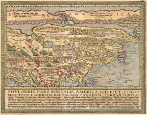
The Art of maps:Matthias Quad – Map of North America 1593

Matthias Quad - Novi Orbis Pars Borealis

Title: Novi Orbis Pars Borealis, America Scilicet, Complectens Floridam, Baccalaon, Canadam, Terram Corte…1585…


Map Maker: Matthias Quad

Place / Date: Cologne / 1600

Coloring: Hand Colored

Size: 12 x 9 inches

Condition: VG+

Price: $3,500.00

Description:

Striking example of Quad’s map of North America, based upon De Jode’s landmark map of 1593.

Jode’s map is one of the earliest maps to concentrate on North America alone. For his map, De Jode condensed information for the map from Dutch wall maps of the late 16th Century De Jode was the first to make use of both John White and Jacques le Moyne’s east coast cartography, although he inaccurately placed it. Quad here continues the mistake of placing the nomenclature of Virginia too far north. A long narrow waterway to the north represents the North West Passage; Lago de Conibas is also indicated. Some names have been surprisingly left out, notably Bermuda, St. Augustine, Roanoke and Chesapeake. A curious ‘second’ peninsula is shown to the west of Florida which could be an early depiction of the Mississippi delta.

The descriptive text below provides a brief overview of the history of North America to date. The projection of California and the West is packed full of annotations and place names. The headwaters of the St. Lawrence extend to Cibola in the mythical Southwest.