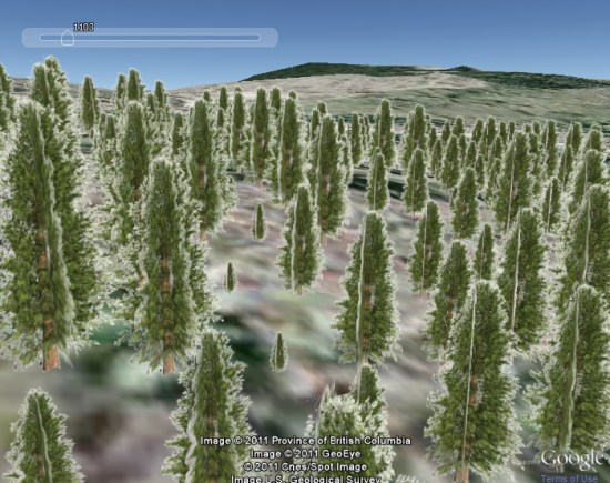
While Google Earth is often used to show past and present conditions on Earth, it’s rarely used to see the future. We’ve seen cool sites like the Blue Marble 3000 and the University of Corsica’s ForeFire, but most focus on showing what we know about right now rather than showing what could happen in the future.
That brings me to Michael Gerzon and his neat idea to use Google Earth to show projections of forest dynamics, both in terms of tree growth and the spread of potential forest fires.

On his site, you can run a few sample demos to see how things work. It’s not using real GIS data at this point, but it’s a neat demonstration and I think it’s the first I’ve seen that shows tree growth in an area.
Expanding the idea out, there are some fun possibilities. For example, you could show what an area would look like after xx years of tree growth, maybe in a new housing development. Combined with 3D buildings, it could be very powerful.