I noticed that Declan wrote up an idea we kicked around in September (see ‘September’ on the DigitalPlanet pages), so I thought it deserved a post. I referred to it then as ‘Dreamweaver for KML.

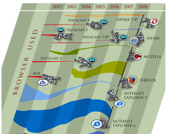
Image courtesy of favbrowser. A bit out of date but still interesting.
Browser History: In 1997 Netscape adds a feature to its Netscape communicator browser that allowed for WYSIWYG simple production of html web pages. To put that in context you have to recall that this was the late days of the browser wars between Microsoft and Netscape. Then in March 1998 Macromedia release dreamweaver 1, this allowed web pages to be created in WYSIWYG or code views and produced short cuts that produced elegant html. It was also extensible so you could write a ‘macro’ to produce custom HTML. Developers loved it.
Geo-Browser History: My point is that if you regard GEarth as a geo-browser then the history is similar. Today in GEarth you can create simple maps and tours just like in Netscape communicator you could create simple web pages. However, a lot of sophisticated features such as time, region control, pauses in tours need to be hand coded into the KML. There are a few tools out there that allow you to produce KML without hand coding such as the spreadsheet mapper, my spreadsheet for adding loops and a tool for adding screen overlays but these are all limited in scope.
Tool Description: An obvious improvement would be ‘Dreamweaver for Google Earth’, where all this functionality was combined into one specialist KML producing program just as dreamweaver was a specialist HTML producing program. It would need to be:
- WYSIWYG, ie be able to write code directly or using wizards and then see the result in an instance of the GE API
- Extensible allowing you to write an extension that produced your favourite snippet of KML structure.
- Elegant, highly usable and producing well formed KML code
So what should its wizards allow you to produce? My list would be:
- Time control
- Screen Overlays
- Functionality producing usable maps e.g. color palettes that avoid color blindness issues
- Simple sketchup models such as a photo billboard
- Region controls
as well as enhancements to editing tools that are already available in GEarth such as better polygon digitising controls.
Flash Editor for Google Earth? So why haven’t I mentioned tours yet? Well, I think the analogy here is with FutureSplash Animator (later ‘Flash’) released by Macromedia in 1996 which was a timeline based tool for producing animations on the web. It pre-dated Macromedia Dreamweaver and was kept separate. To me, it makes sense that a Google Earth tour is an animation so it needs a separate animation editing tool that is timeline based, I explain in more detail here (although I discuss it by comparison Captivate, another timeline based tool).
So Why aren’t you Building these programs then? because if I did, and it was a sucess, a certain company ending with ‘Oogle’ and beginning with ‘G’ would bring out a rival and completely blow me out of the water. Instead this is a lazy web request.