The Nabro volcano in the northeast African nation of Eritrea erupted for the first time in recorded history following a series of earthquakes. The ash has since spread more than 60km over the Ethiopian border and the volcano has emitted the highest levels for sulfer dioxide gas ever detected from space.
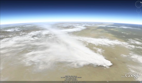
NASA has been publishing a small stream of images from the volcano, including some stunning shots such as the one seen above. Even better, they happened to capture a photo of Nabro back in January of this year, providing a crystal clear shot of the volcano prior to the eruption.
You can view that image on NASA’s site, or in Google Earth using this KML file. 
The volcano has caused some minor disruption to air travel, but nothing on the scale of Eyjafjallajokull eruption in Iceland last year. Even better, the level of ash coming out of the volcano has begun to diminish, as has the level of seismic activity in the region.
Be sure to check out the full gallery of images on the NASA Earth Observatory site to see all of the amazing imagery that they’ve captured so far.