Garmin: New features and capabilties for G3X


G3X 2-screenThe software update theme continues this week as we address some recent software upgrades to the G3X system. Last month, version 6.40 was released, which includes many new features and capabilities including support for GTS 8xx traffic systems, the option to display the G-meter on PFD, the option to display track-up orientation on the PFD HSI, added support for GNS 480 MapMX data and more. Get this update free from the Garmin website!

Here’s a closer look at what you’ll get with the new G3X software:

The G3X can now interface with the GTS 8XX traffic systems, allowing the G3X to display traffic information for transponder-equipped aircraft in your vicinity. To assist with traffic advisories, aural traffic alerts are possible as well.

Another new feature is MapMX, which is now available when using the GNS 480 as your external GPS navigator. This feature allows the G3X to display a more accurate flight path on the moving map page, including procedure turns and holds.

G3x_track_hsi_2displayYou can also now display the HSI instrument on the PFD in a track-up orientation. Put simply, this feature automatically rotates the HSI to put the aircraft’s ground track at the top, which lets you fly with the course pointer at the top of the instrument regardless of crosswinds. In this screenshot, you can see that a 26-knot direct crosswind is trying to push us off course, but the HSI has rotated to show the ground track at the top; magnetic heading is still available on the heading tape at the top of the display. This handy feature can help reduce the pilot’s workload by taking the guesswork out of wind correction angles, which makes following the desired course a “breeze”.

G3x_g_meter G3x_g_meter_setupFor those who are looking to be a little more adventurous, we’ve added a large, easy-to-read G-meter to the PFD. The range of G values displayed on the gauge can be configured to match your aircraft, and there are indicators to show the maximum positive and negative G’s recorded since last being reset by the pilot.

Garmin’s multi-sensor controller concept for infotainment systems helps reduce driver distraction


Garmin Multi-Sensor Controller Concept_Close-up

With the increasing use of technology and smartphones behind the wheel, driver distraction has become a concern. But technology in general is not the problem. The most important question is how it is being used and integrated into the car so that it doesn’t distract drivers. Garmin’s new multi-controller concept provides a new and unique way of controlling essential functions of an in-car infotainment system, such as audio, apps, communications and navigation. It is a concept development from Garmin’s automotive OEM group, providing further research for enhanced reduction in driver distraction.

Garmin Infotainment Multi-Controller Concept Audio Low Res

Garmin’s concept positions the screen higher up on the dash inthe driver’s eyesight and combines it
with a rotary infrared controller in convenient reach, a touch pad, and menu mode buttons. The infrared sensors of the rotary controller automatically detect an approaching hand and the system reacts by displaying menu options even before it is touched. Because the system “knows” when a user is reaching for the controller, menu buttons on the screen are hidden when not needed. At all times important information, such as driving directions and the name of a song or radio station is kept at the top of the screen so the driver always has a single reference point. Four buttons with infrared sensors on the rotary controller allow switching between different menus, such as audio, apps, communications and navigation.

In addition to the rotary controller, radio preset buttons with infrared sensors are positioned below the screen to allow a driver to feel for the right button without having to press it – when their finger is close to a preset button, a highlighted preset image appears on the display, allowing the driver to select a station.

Tied into this system can be HVAC controls, vehicle bus information, connected services and apps from a smartphone. Existing technology like text-to-speech, voice command, Bluetooth hands-free calling and traffic services also helps alleviate driver distraction to avoid potentially dangerous situations.

Garmin’s automotive OEM group utilizes the company’s long-standing experience in interface and hardware design from its automotive, avionics and marine segments to develop innovative in-car navigation, telematics and infotainment systems. Garmin already provides integrated cockpits to the aviation industry and is dedicated to bring a similar level of technology, integration, safety, reliability, and efficiency to the automotive market. Garmin recently announced its first fully integrated infotainment system for most 2013 Suzuki vehicles.


The Garmin’s Course Creator

With today’s Garmin Connect update, navigation on bike lanes, running and hiking trails, and walking paths just got a whole lot easier. Gone are the days when you’d have to stop during your best trail run, epic hike or cycling adventure to take out your paper trail map and double check that you are headed down the right path. Now you
can use our Course


Creator – and with a few simple mouse clicks you can draw your route using Google maps, save it and send it directly to your compatible

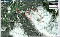
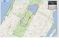
Garmin device. With Google maps, you can even show your local bike lanes in Kona, HI, jogging paths through Central Park, and even hiking trails in Whistler, BC to name a few great destinations!

Once your course is saved, you can allow it to be stored publicly for users around theworld to view and they can send to their devices so they can experience your favorite route as well. This feature, we call Explore, is great when travelling to a new city, away on business or for those who want to break their same old routine and try a new route.


You’ll also notice an improved ability to zoom on our number of detailed graphs when analyzing your most recent adventure.