The Microsoft 311 Service Center with Bing Maps


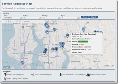
Microsoft now has an all-in-one fully integrated solution for city governments with the 311 Citizen Services Center. It combines the power of several Microsoft technologies and has both a citizen-facing portal and a back-end management module, including interactive Bing Maps for both components. When cities use the 311 service center, citizens can easily report outages, potholes, etc. by locating them on a map. City workers and contractors can use Bing Maps for service request information and updates. 311 Service Center is another great example of how Bing Maps integrates with

Microsoft Dynamics® CRM to show the data the customer is managing, and to speed up the decision process.

To learn more about how your city can benefit from the Citizen Services Center (311), visithttp://www.microsoft.com/gov311 and watch this video.


Citizen-facing portal with self-service and multi-access channels


Bing Maps Aerial Imagery into Desktop themes

Some of the best imagery from the Bing Maps Global Ortho Project is collected into Windows 7 Desktop Themes.  These themes change your PC desktop experience as the images rotate through on a regular basis so you never know which part of the world you’ll be looking at next! The United States version is the most content-rich Windows 7 Desktop Theme with nearly 200 images from all parts of the Continental United States, and has had almost a million downloads. The European version just launched last month and contains photos from 10 different countries in Western Europe. Once downloaded, both of these themes are updated through RSS feeds as new imagery is available. For a deeper dive on these themes, check out this post . What are you waiting for? Go download one today!

Bing Maps Aerial Imagery – United States
Windows 7 desktop theme
Click here to Download
Click here for Details

Bing Maps Aerial Imagery – Europe
Windows 7 desktop theme
Click here to Download
Click here for Details

The Garmin’s Course Creator

With today’s Garmin Connect update, navigation on bike lanes, running and hiking trails, and walking paths just got a whole lot easier. Gone are the days when you’d have to stop during your best trail run, epic hike or cycling adventure to take out your paper trail map and double check that you are headed down the right path. Now you
can use our Course


Creator – and with a few simple mouse clicks you can draw your route using Google maps, save it and send it directly to your compatible

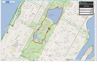
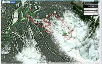
Garmin device. With Google maps, you can even show your local bike lanes in Kona, HI, jogging paths through Central Park, and even hiking trails in Whistler, BC to name a few great destinations!

Once your course is saved, you can allow it to be stored publicly for users around theworld to view and they can send to their devices so they can experience your favorite route as well. This feature, we call Explore, is great when travelling to a new city, away on business or for those who want to break their same old routine and try a new route.


You’ll also notice an improved ability to zoom on our number of detailed graphs when analyzing your most recent adventure.