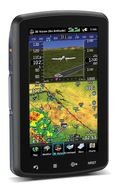
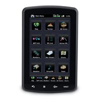
 Garmin announced its newest flagship aviation portable GPS series, the aera 796 and aera 795. These new devices have all of the great features you have come to know and love from a Garmin aviation portable like a 5 Hz GPS receiver, the patented Panel Page and XM weather integration, plus the aera 796/795 is enhanced with even more features that make it Garmin’s most capable aviation portable yet! Some new additions include a touchscreen user interface, pilot-selectable screen orientation and 3D Vision.
What is 3D Vision?
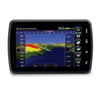
3D vision is a unique 3D view of the surroundings outside the aircraft. It uses GPS position and the terrain-alerting database to recreate a behind-the-aircraft perspective view of the topographic landscape. The resulting virtual reality display offers pilots a supplemental 3D depiction of land and water features including terrain, obstacles, runways and airport signposts all shown in relative proximity to the aircraft. With the flick of a finger, the 3D view can be rotated around the aircraft to easily view the surrounding terrain.
A path to a paperless cockpit
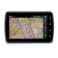
 Because of the comprehensive offering of electronic charts, the aera 796 may be qualified for use as either a Class I or Class II Electronic Flight Bag (EFB). Geo-referenced IFR Enroute charts and VFR Sectional charts come pre-loaded, and the aera 796 also includes geo-referenced Garmin FliteCharts®, an electronic version of the AeroNav U.S. Terminal Procedures Publication. For pilots who prefer Jeppesen charts and diagrams, Garmin also offers a ChartView enablement option. Garmin ChartView utilizes Jeppesen’s extensive library to provide global charting capabilities. More “paperless” offerings include a digital document viewer, scratch pad and pre-loaded geo-referenced AeroNav IFR and VFR enroute charts.
Plus a large touchscreen display
The large icons on the high-resolution 7-inch touchscreen display make this device so easy to use. Using your finger, you can quickly pan across the map, pinch zoom and quickly access information. The icons along the bottom row of the display are even customizable, so you can pick your favorite features and anchor them at the bottom of the display for even faster access.
The aera 796/795 will be on display and available for purchase next week at the AOPA Aviation Summit in Hartford, Connecticut. Come by and visit us! If you can’t make it to the show, but want to get your hands one one, visit your local Garmin authorized dealer.
PilotPak: Databases for the entire aircraft, for a single annual price
Aviation databases in the cockpit just became more affordable! PilotPak is our newest offering that allows our customers to buy a bundle of databases for select Garmin panel mount avionics, all at once and for a single annual price. Not only that, the purchase of a PilotPak will provide databases for all of your Garmin equipment in the cockpit. The databases within the selected package can be used with any combination of GTN™, G600, G500, G500H and G3X installed in one aircraft. Each bundle option includes Garmin’s popular SafeTaxi®, Obstacle, Terrain and Airport Directory, and customers are able to choose between bundle options that include Jeppesen NavData, Jeppesen JeppView and/or Garmin FliteCharts®.
The more Garmin avionics you have, the more you save! For example, with a PilotPak Standard Americas subscription, you can enjoy 20 percent savings on databases for a single GTN or 60 percent savings with the inclusion of a G500 when compared to purchasing annual subscriptions to each database individually. When Garmin’s FliteCharts are included, the savings on databases for a single GTN 750 amount to over 30 percent and when combined with a G500, you save over 70 percent.
