Paris Open Data Released

Paris Open Data Released

Paris OpenData in many different data types.

The data held by the City of Paris are fully exploited by the municipal services as part of their missions, but are also an intangible heritage that can be developed for the whole community:

  • researchers can find material to feed their work and experiences,
  • developers can create innovative services using these data,
  • citizens and journalists to find raw information,
  • companies can provide added value to these data, and thus create jobs and wealth for the community.

The movement “Open Data” (open data) is to get any type of structure, including local authorities around the world, the provision of all, free and free of electronic data. More Data to come in the weeks.
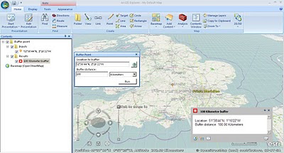

Now map it.
Paris Open Data Released in Open Street Map
Already in OpenStreetMap – http://demo.3liz.fr/opendataparis

ArcGIS Explorer (Build 1500) Released

ArcGIS Explorer (Build 1500) Released

ArcGIS Explorer Build 1500 Released

View OpenStreetMap in 3D (2d is default) via basemaps
ArcGIS Explorer Build Open Street Map in 3D
ArcGIS Explorer Build import your data
Import your .shp, .kml, .gpx, .txt, .csv or even File Geodatabases!
“KML improved; KML handling has been improved in both 2D and 3D mode, and regionated KML is now supported in 2D mode. KML interoperability has also been enhanced; notes can be shared (exported) as KML and KML can be shared (exported) as layer packages or converted to notes. The KML file association can be set to ArcGIS Explorer.

Symbols (more); ArcGIS Explorer symbols have been updated to improve appearance in 2D and 3D modes. Symbol management tools have been enhanced with improved support for custom (user) symbols.”

Buffering a point by 100km is possible via Analysis

ArcGIS Explorer Presentation Slide
Create driving directions, add slide (like screen grabs) to presentation – playback is full screen and glides to various screen grabs.
ArcGIS Explorer features new capabilities that enhance interoperability with the ArcGIS system and KML. These features include:
ArcGIS Online integration
Support for ArcGIS Explorer Online maps, including presentations and notes
Share (export) to layer package or KML
Create notes from features
Create notes from KML
Add data directly from Excel spreadsheets

Download here [98.4mb]:
Useful Links
Source:
Mapperz Mapping News Blog