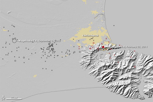
With this map, Earth Observatory connects the two major earthquakes to hit Christchurch, New Zealand:
This map shows the earthquakes that occurred near Christchurch since September 3, 2010. On that day a magnitude 7.1 quake struck to the west of Christchurch. Black circles represent earthquakes from September 3, 2010, until February 21, 2011. Red circles show the locations of the magnitude 6.3 quake and aftershocks on February 22 and the morning of February 23. Larger circles represent stronger earthquakes. Yellow shows urban areas, including Christchurch.