I’m a window seat person. If given the choice on a plane, I will always take the window seat, and not just so other passengers need not climb over me while I sleep. It’s also because I love the views during take off and landing. Whether it’s flying out over Sydney Harbour, or coming in to land over the Houses of Parliament in London, the view from a plane is a unique perspective on the world below.
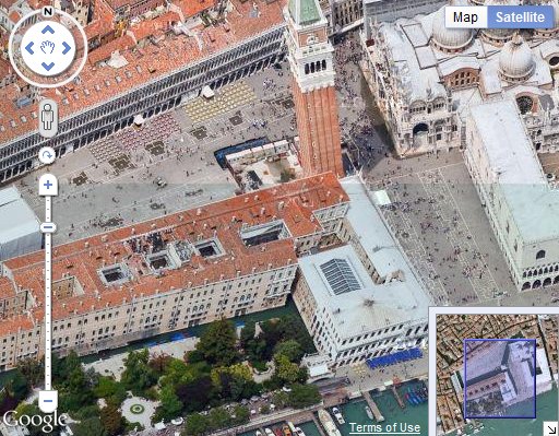
Starting today you can bring that perspective to your Maps API applications with the launch of 45° imagery in select cities around the world. 45° imagery offers a superior perspective of city skylines than an overhead view. Tall buildings stand out from those around them, and iconic landmarks such as St. Mark’s Square in Venice are instantly recognisable. In addition you can rotate the map to look at buildings from all four sides:

You can track the cities where 45° imagery is currently available on this map. When 45° imagery is available a submenu option is added to the Maps API Satellite button. Right now the overhead imagery remains the default view for these areas. However in three weeks time this will change to match Google Maps, and the 45° imagery will become the default Satellite view where available.