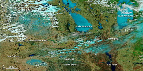
NASA’s Earth Observatory has a number of satellite images of the spring flooding in the Canadian Prairie Provinces and the U.S. Upper Midwest. The most recent image, above, is a MODIS image combining visual and infrared views of the flooding in southern Manitoba on April 24.