Back in February, the Kansas Department of Transportation announced its new Airspace Awareness tool , which they recently launched.
The software, funded by a grant from the Federal Aviation Administration, allows pilots to visualize data that is normally only presented in 2D charts or apps, rather than the 3D data available here.
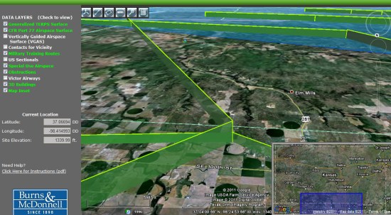
According to the Aircraft Owners and Pilots Association, there were more than 2,000 airspace analyses performed in Kansas in 2010, some of which resulted in conflicts with local airspace. With this application in place, the system will alert users to contact the FAA in the event of any potential aispace conflicts with tall structures, such as wind turbines.
As of right now, Kansas is the only state with this kind of system in place, but if things go well I expect we’ll see other states introduce similar applications in the near future.