Back in architecture school, I once had to lay out a parking lot for a building I was designing. What a terrible, terrible exercise in nitpicky details and perpetual re-arrangement. The solution I came up with accommodated all of four Smart cars and a unicycle. Awful. If only I’d had access to a tool like SITEOPS from BLUERIDGE Analytics.
SITEOPS is conceptual land development software for folks like architects, civil engineers, landscape architects and land developers. After you’ve brought in a site, you can combine building footprints with critical elements like parking, islands and driveways. These elements are parametric, meaning that they re-draw themselves on the fly as you change aspects of your conceptual design. SITEOPS even provides budget tools for estimating the cost of a project.
Want to see what a parking layout might look like if your building were on the other side of the site? As you slide it over, the parking lot automatically reconfigures to maintain the proper number of spaces. Too cool. This short video shows SITEOPS it in action:
Realizing that lots of their users are also SketchUp devotees, the good people at BLUERIDGE have added an Export to SketchUp button to their product. It lets you figure out the complicated stuff in SITEOPS, then visualize your project in SketchUp. It’s available to SITEOPS customers who have also purchased the Grading and Piping Module. These pictures tell the story better than words can:
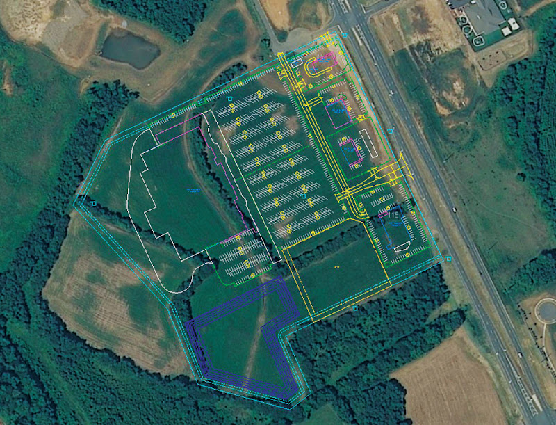 This is a view of a 2D site layout in SITEOPS.
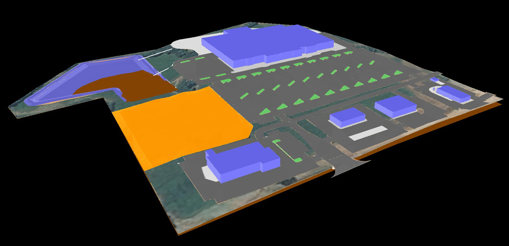 A 3D image of the same site in SITEOPS’ Grading and Piping Module.
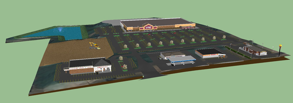 The site after it’s been exported to SketchUp. The model includes all of the 3D topographical information from SITEOPS.
 to quickly find the venues in question.