The Eiffel Tower is one of the most popular sights in Google Earth, and it’s had a high-quality 3D model for a few years now. However, the rest of the city has been rather flat — until now.
Google has rolled out extensive 3D building coverage for the city and it looks great! (NOTE from Frank: There are some areas – especially around the Eiffel Tower, where the building models look half-finished. Many of the sides are missing photo-realistic textures. But, hopefully this will inspire people to use Building Maker to finish the models.]
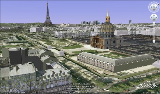
Check out some of the cool sites like the Eiffel Tower, the Notre Dame Cathedral or the the Arc de Triomphe.
To simply explore the city for yourself, fly there using this KML file .
.