2012 Model Your Town Competition

Over the past several months, hundreds of teams from all over the world have submitted stunning geo-models for our Google Model Your Town Competition. These examples of pure 3D civic pride are breathtaking to behold. Difficult as it was, the SketchUp team managed to pick six finalists, after which we asked the general public to vote for their favorite collection of models. Tens of thousands of you weighed in, and the talented team from the north of Spain were victorious. Zorionak! (That’s “Congratulations!” in Basque.)

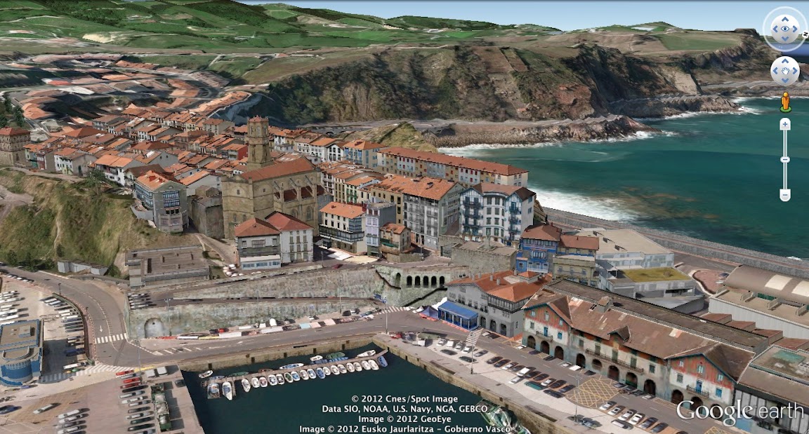
The winning team is a dynamic duo: Josetxo Perez Fernandez, 36, is a professional who works in computer administration; and Pedro Domecq Aguirre, 45, is a programmer, 3D data specialist and network administrator. Those are their day jobs, anyway. It turns out that they’re actually world-class, polygon-wrangling, texture-mapping, megabyte-optimizing, geo-modeling superheroes. And now they’re bona fide local heroes, too. Thanks to them, millions of people across the globe can now get familiar with the beautiful little town of Getaria.


The beautiful coastline of Getaria

Not only that, but we’ll also be awarding US$25,000 to a local school and hosting a celebration with the town of Geteria in honor of Pedro’s and Josetxo’s accomplishment.


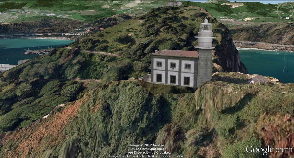
Getaria Lighthouse on Mount San Antón

Zorionak to the winning town, to the other five finalists, and to all the other entrants who collectively modeled almost 25,000 local landmarks that are now available for all to enjoy in Google Earth’s 3D Buildings layer. The virtual world is a richer place thanks to your efforts, and the real one is a lot better off, too.
Google Maps: New 45° imagery available for 56 cities

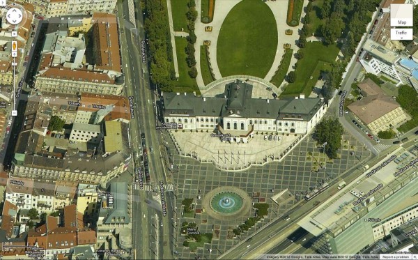
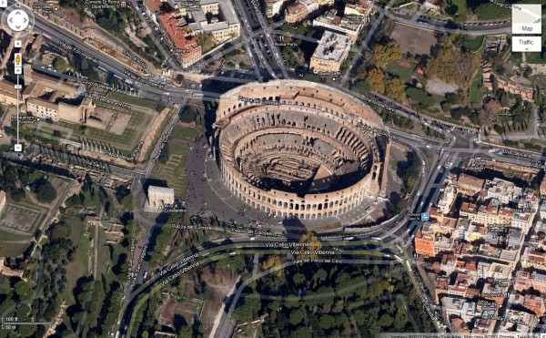
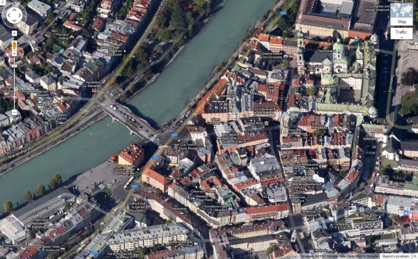
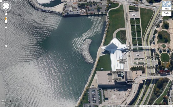
The latest 45° imagery update in Google Maps is a big one; it features new imagery for 23 U.S. and 33 international locations. This also marks the first time we’re publishing 45° data for the Czech Republic and Slovakia.

Bratislava is the capital of Slovakia. Due its location along the Austrian-Hungarian border, the city has been visibly influenced by several cultures. The imagery below features the beautiful Grassalkovich Palace, a Baroque-style summer residence which is now the residence of the Slovakian president.

 
View Larger Map

As the former capital of the Roman Empire, Rome is one of the most famous cities in the world. Historically attracting the best artists, sculptors and architects, Rome was a cradle of western civilisation. Now, its extraordinary monuments and museums make it among the world’s most visited tourist destinations. The map below shows the Colosseum that was erected in about 80 AD as a theatre for public events like gladiator fights.


View Larger Map

Innsbruck, located in the Austrian Alps, was a former residence of the Habsburgian emperor, Maximilian I. Several buildings, like the Hofkirche and the Goldenes Dachl, that date back to that era still stand. Today, Innsbruck is a popular winter resort that has hosted the Winter Olympics twice.


View Larger Map

Milwaukee, Wisconsin originated as a French trading post in 1785. In the nineteenth century, German immigrants played a key role in defining Milwaukee’s unique character by establishing infrastructures like a freely accessible lakeshore and a system of public transport. These days, Milwaukee has many major attractions including the Milwaukee Riverwalk, Miller Park, and the internationally renowned Milwaukee Art Museum.


View Larger Map

Have fun exploring the new sites!

Below is the full list of updated cities:

US:
Athens, AL; Augusta, GA; Belen, NM; Fairfield-Travis Air Force Base, CA; Fort Myers, FL; Graniteville, SC; Jackson, MS; Lakeside FL; Lakewood, WA; Liberty, KS; Lillian, FL; Livermore, CA; Magna, UT; Manteca, CA; Midland, TX; Milwaukee, WI; Moores Mill, AL; Prattville, AL; Shreveport, LA; Summerville, SC; Waco, TX; Yukon, OK; Yuma, AZ

Austria:
Innsbruck; Wiener Neustadt

Czech Republic:
Brno; Frýdek-Místek; Hradec Králové; Jihlava; Karlovy Vary; Liberec; Most; Olomouc; Pardubice; Plzen; Praha; Teplice; Ústí nad Labem; Zlin

Italy:
Napoli; Roma


Slovakia:

Bratislava

Spain:
Alicante; Aranjuez; Cabo Roig; Ciudad Real; Elche; Huesca; Iruña de Oca; Jaen; Las Rozas; Logroño; Salamanca; Segovia; Vitoria

Switzerland:
Genève

Protecting the world’s coral reefs through mapping

Editors Note: Today’s guest author is Katie Reytar, a Research Associate for the World Resources Institute. WRI was the recipient of a Google Earth Outreach Developer Grant, funded through the Google Inc. Charitable Giving Fund at the Tides Foundation. We’re excited to help them share and visualize the results of years of research about the state of the world’s reefs.

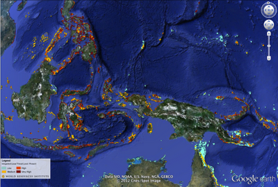
Since 1998, the World Resources Institute (WRI) has been using GIS (Geographic Information System) models to develop map-based assessments of threats to the world’s coral reefs. Reefs at Risk Revisited, released in February 2011, is the latest assessment in the series and is based on a nearly three-year study that produced the most highly-detailed global maps of coral reef threats to date. The study analyzed and mapped threats to coral reefs from local human activities such as coastal development, unsustainable fishing, and marine and land-based pollution, as well as climate-related threats caused by increasing levels of greenhouse gases in the atmosphere.

While the Reefs at Risk Revisited report, maps and data sets are the core components of our work, we found ourselves still searching for a compelling way to convey our findings on these dynamic yet fragile reef ecosystems. We also wanted to generate greater awareness of the unique characteristics of reef habitats across different geographies and the irreplaceable cultural and life-sustaining services that reefs provide to people all over the world. All of these elements are best communicated when you can see them for yourself, which is why we created a virtual tour of these reefs around the world with our Google Earth Outreach Developer Grant.


Watch a virtual tour of the most at-risk reefs in the world courtesy of the World Resources Institute.


In the tour, the Reefs at Risk Revisited maps come alive on Google Earth with photos and underwater video from each of the major coral reef regions of the world: the Caribbean, Middle East, Indian Ocean, Southeast Asia, Australia, and Pacific, as well as a global-level introduction and conclusion. The journey to each region provides a brief overview of the biodiversity of reef ecosystems, their importance to people and local economies, and the types and magnitudes of threats that reefs face, illustrated with footage of both healthy and damaged reefs.

You’ll also experience first hand these fantastically dynamic and productive ecosystems that extend across about 250,000 sq km (96,500 sq miles) of the tropical ocean. Even though this area represents less than 0.1% of the global ocean, reefs are home to as many as 25% of all known marine species. In the tropics, coral reefs are not only a critical habitat for marine species, but they also play an essential role in the lives of millions of people who live near them: they provide food and income from fisheries, revenue from tourism, and protection for coastal communities from storm surges.

Among the other products of the Reefs at Risk Revisited project are global maps of coral reefs rated according to level of threat in the present, 2030, and 2050. These maps are available as downloadable KML files on the WRI website for viewing on Google Earth, and also as part of an online map developed using Google Fusion Tables. With these interactive maps you can zoom in to your favorite reef to explore it more closely in your own self-guided tour.

Explore Reefs at Risk Revisited in Google Earth.

We hope that you enjoy our tour and maps, and that you are able to visit a coral reef to learn more about these important and unique ecosystems. With improved understanding, we can manage and protect these resources so that we can all enjoy them and benefit from them for generations to come.