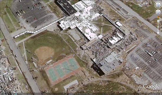
It’s been a few days since a devastating F5 tornado ripped through Joplin, Missouri, and we’re just starting to get some aerial imagery of the area. GeoEye, by way of MJ Harden and their digital imaging aircraft, has posted an amazing image of the area around Joplin High School:
I presume that the lack of recent satellite imagery of the area is due to the continuing bad weather (and subsequent clouds) in the area. I expect we’ll see more once the weather clears up.
For this particular image, you can view details on the GeoEye site or download this KML file to view it in Google Earth.