The World Wonders Project


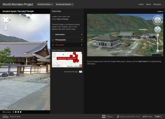
There are a lot of amazing sites around the world, and thanks to Google’s various technologies such as Street View and Google Earth they’re easier to explore than ever. Google has now taken 132 historic sites from around the world and put them together into a single showcase called the World Wonders Project.


world-wonders.jpg 

The project covers major sites that we all know about, such as Stonehenge and Pompeii, and also covers lesser-known sites that are quite amazing, such as the Historic Villages of Shirakawa-go and Gokayama. This video shows a bit more about how it works:


The sites all include Street View imagery (much of which was captured using a Street View Trike), photos, videos, and 3D models in Google Earth.

Street View: Ski and snow

From the streets to the slopes, Street View in Google Maps recently updated its special collections to include a number of new ski resorts, so you can tour some of the world’s most beautiful ski terrain right from your browser. Whether you’re planning your annual trip to your favorite resort or hunting for an exciting new adventure, Street View can transport you to your desired destination. Tour a few of our favorite ski resorts below.

First stop off the ski lift is the world famous Squaw Valley, in northern California. Squaw Valley has been a ski destination since it hosted the Olympic Winter Games in 1960.
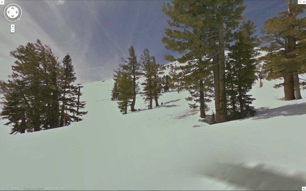
Squaw Valley Resort – Going down Gold Coast Face

Following a record setting 519 inches of snowfall last season, Breckenridge Ski Resort is celebrating its 50th anniversary this year. Take a tour of this famous Colorado destination.
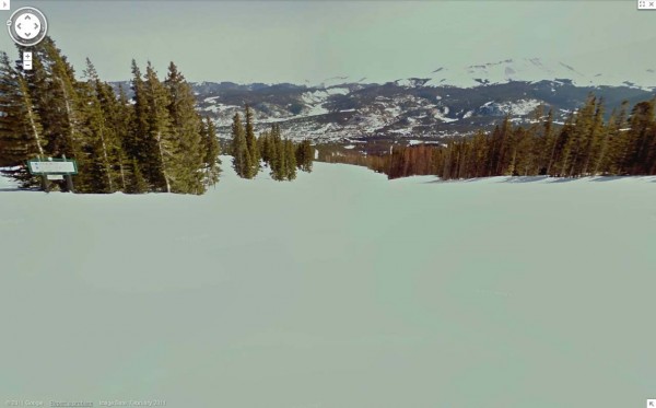
Breckenridge Resort, Looking down Four O’Clock

Last, but surely not least, you can tour Whistler Blackcomb, home of the 2010 Winter Olympics. We captured Whistler with our Street View cameras last year and made some recent updates. Located in the Coast Mountain range of British Columbia, Whistler, known for both its scenery and adrenaline-pumping runs, is one of the most famous ski destinations in the world.
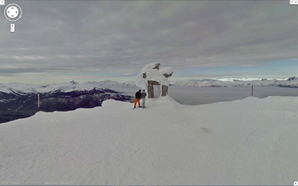
Whistler Blackcomb, Whistler Peak

All snow view imagery was captured by the Street View snowmobile which made its debut two years ago at the Winter Olympics in Vancouver. To get a glimpse of a few more resorts you can go to the gallery or watch the video:

Whether you’re a snowbird, a beach bum, an urban adventurer or something else entirely, there’s something for everyone in our growing set of Street View collections. To see some of our favorite special collections, visit the Street View gallery.
Map Maker: from Afghanistan to Antarctica

Google Map Maker enables local experts to create maps and share their local knowledge with the world. These citizen cartographers help keep maps of their areas accurate and up to date. They add missing roads and new businesses—and even map areas that have little to no data yet on Google Maps.

Today, our latest crop of countries, territories and an entire continent are graduating from Map Maker—meaning the user-generated maps of these countries will now appear on Google Maps: Afghanistan, Antarctica, Ecuador, Georgia, Guatemala, Heard Island and McDonald Islands, Honduras, Iraq, Norfolk Island, Saint Pierre & Miquelon and Saudi Arabia.

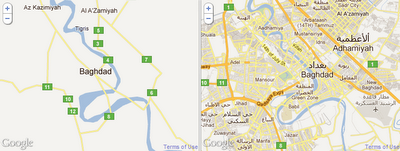
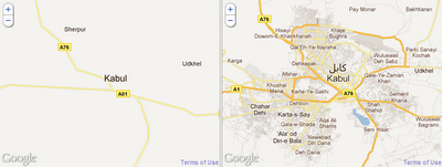
Here are some before and after pictures that highlight how much detail Map Maker users have added to Google Maps for these regions (as well as some time-lapse videos):

Baghdad, Iraq

Kabul, Afghanistan

Tbilisi, Georgia

Each region has an impressive mapping story—from the Georgian Government’s initiative to improve their country’s map, to the group led by six students in Herat, Afghanistan who mapped their entire city in a matter of weeks.

Thank you to the Google Map Maker contributors who create better maps for these regions and others; their ongoing efforts can be seen at Map Maker Pulse. We encourage all local mappers to continue improving the maps of these areas and the more than 180 other regions of the world on Google Map Maker.