The New Google Earth 6.2

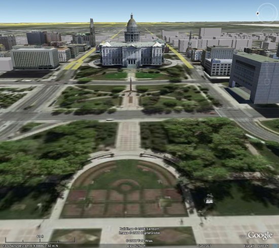
We’re taking bird’s eye view to a whole new level with the latest version of Google Earth, released today. With Google Earth 6.2, we’re bringing you the most beautiful Google Earth yet, with more seamless imagery and a new search interface. Additionally, we’ve introduced a feature that enables you to share an image from within Google Earth, so you can now simply and easily share your virtual adventures with family and friends on Google+.


A seamless globe

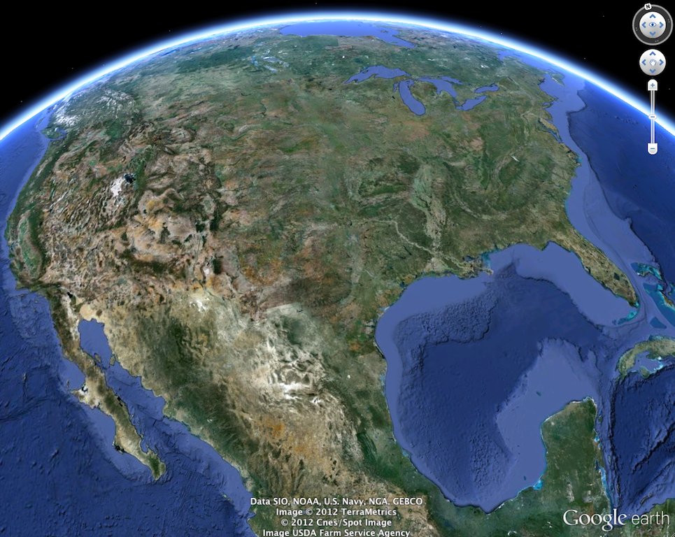
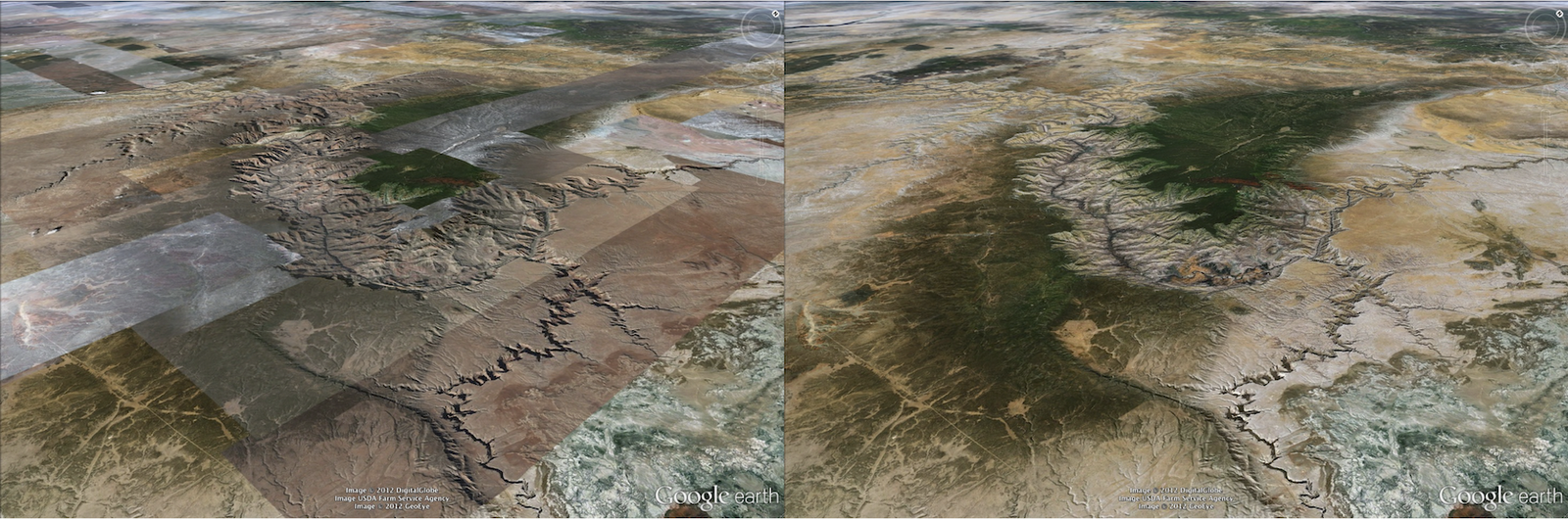
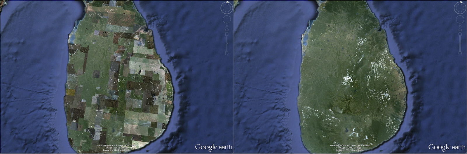
The Google Earth globe is made from a mosaic of satellite and aerial photographs taken on different dates and under different lighting and weather conditions. Because of this variance, views of the Earth from high altitude can sometimes appear patchy.

Today, we’re introducing a new way of rendering imagery that smoothes out this quilt of images. The end result is a beautiful new Earth-viewing experience that preserves the unique textures of the world’s most defining geographic landscapes—without the quilt effect. This change is being made on both mobile and desktop versions of Google Earth. While this change will appear on all versions of Google Earth, the 6.2 release provides the best viewing experience for this new data.

Grand Canyon before and after

Sri Lanka before and after

Share your explorations with Google+

Google Earth is a great way to virtually explore the globe, whether revisiting old haunts or checking out a future vacation spot. With the Google Earth 6.2 update, we’ve added the option to share a screenshot of your current view in Google Earth through Google+. If you’ve already upgraded to Google+, you can share images of the places you’ve virtually traveled to with your Circles, such as family, friends or your local hiking club. To try this new feature, simply sign in to your Google Account in the upper right hand corner of Google Earth and click “Share.” Images of mountains, oceans, deserts, 3D cities, your favorite pizza shop on Street View—you can now experience all these amazing places around the world with people on Google+.


Search improvements

We’ve also made some updates to the search feature in Google Earth. Aside from streamlining the visual design of the search panel, we’ve enabled the same Autocomplete feature that’s available on Google Maps. We’ve also introduced search layers, which will show all the relevant search results (not just the top ten), so now, when looking for gelato in Milano, you can see all the tasty possibilities. Finally, we’ve added biking, transit and walking directions, so if you’re itching for a change of scenery or looking for a new route for your regular commute, you can now use Google Earth to generate and visualize all your options.

via: Google Lat Long blog

Gallery of Inappropriate Bubble Ads


This search for “Child Protection Services, NY” provides an obvious example of Google’s inability to target a specific ad against a specific place with their new Info Bubble Ads.

There is some irony that the Archdiocese of New York* is sandwiched between Children’s Rights and the NY Society for the Prevention of Cruelty to Child in the Map search results and I suppose the bottom ad for a Child Protection Lawyer is somehow oddly relevant in this context.

But the ad for the Gay Church service shown against the Archdiocese manages to clearly demonstrate Google’s (lack of ) ability to target these ads correctly. It adds fuel to the already inappropriate fire that is the Bubble Ad… I never knew that the Adwords algo had such a twisted  sense of humor.

In attempting to match a single ad to a single Place in Google Maps raises multiple issues…..

1)Certainly business (and churches & political organization for that matter) have a new arena where they need to worry about reputation management. They now have to think about “defending” themselves against ads from competitors or groups that disagree with their position….This drives ad growth and is likely to drive up bid prices for Google. While this occurs for all the wrong reasons I believe that they ones of which Google is likely aware. I had heard rumors in early September of Adword Account Reps instructing large Adword clients to take out ads in Google Maps in anticipation of this rollout.

2)The algo is incapable of correctly understanding which Places should have ads and which shouldn’t. This makes every Place in the virtual universe a target for an ad. Churches which are in theory a sanctuary from commercialism lose that… somber memorials become just another opportunity for a pitch.

3)Content that is abhorent or antithetical to the Place in real life can be associated with the Place virtually. The algo does not posses any ability to distinguish relevancy at a granular enough level to provide truly relevant ads that respect the intentions and aspirations of a given place. But worse, ads that are totally inappropriate by most human standards become acceptable.

4)At the end of the day, many of these ads are disrespectful of the user that made the effort to dive deeply into Google and find out more information about a given place.

There is the argument that the low visibility of the ad location somehow obviates the offense. My experience with Google Maps is that it is a testing ground for the big show. Single ads against single Places will migrate outward and upward if they are successful within Maps.

Like Facebook is pushing the limits of privacy in an effort to have none, Google is pushing the limits of ad display so that there are no societal limits on where or when ads can be displayed. Clearly breaking down societal mores that provide implicit boundaries to advertising is in Google’s best interest. I am not sure that it is the interest of either the general public nor the small business community.

*Note that I have no love lost on the Archdiocese of NY and they certainly have only themselves to blame for any problems that they have. That doesn’t deny my belief that they, and any church for that matter, should not have to worry about how Google uses their info bubble.

Google Earth: 3D trees added to Boulder, Denver and Los Angeles

The addition of trees to Google Earth 6 was an awesome enhancement that made some big cities in Google Earth look remarkably more realistic. While they’re rolling out at a fairly slow pace, it’s nice to see Google continue to push it out to a few more cities.

The newest cities to get the trees are Boulder and Denver, Colorado and Los Angeles, California.

The new trees in Denver are of particular interest to me. I wrote a post on Digital Earth Blog more than three years ago comparing Denver in Google Earth and Microsoft’s (then-titled) Virtual Earth. At the time, Virtual Earth looked far better than Google Earth thanks to the trees. However, Google Earth has blown way past the look of Virtual Earth thanks to the improvements in satellite imagery and 3D buildings in the past few years.

First, here’s a look at the Colorado State Captiol building in Google Earth circa 2007. There are a few modeled buildings, a handful of gray buildings, and certainly no 3D trees:

ge-denver-2007.jpg

Next, here’s a shot from Virtual Earth, also in 2007. There are quite a few more 3D rendered buildings, but the textures on them aren’t very sharp. The trees are a nice touch, though:

ve-denver-2007.jpg

Finally, here’s a look at the same view in Google Earth, as seen today. The buildings are amazingly sharp, and the trees look far more realistic than what we saw in Virtual Earth in the past:

ge-denver-2011.jpg

This comparison helps to show why Google is taking so long between cities with the addition of 3D trees — they’re doing it right. Rather than clumps of virtually identical trees like you saw in Virtual Earth, they’re taking the time to get the right species and height of each tree. The results speak for themselves.

To see these new trees, simply search for Boulder, Denver or Los Angeles in your Google Earth search window and make sure you have [Trees] enabled in the [3D Buildings] layer.

Google Lat Long Blog