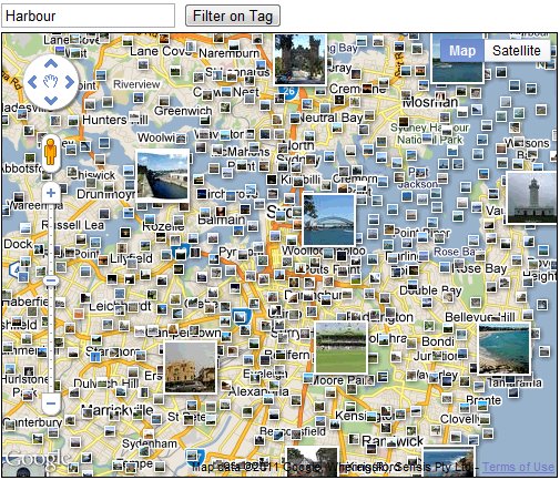
When looking at a Google Map it’s not always easy to get a sense for what the area looks like on the ground. Satellite imagery can indicate the terrain, whether it is urban or rural, desert or mountainous, and Street View can help in built up areas. But to convey the beauty of more scenic locations you really need a photograph.
For this reason we’re happy to make available the Photos layer from Google Maps to Maps API developers. The Photos layer adds thumbnails of geotagged photos to the map, which are sourced from Panoramio. They are a great way to add additional context to a map, and an on the ground perspective. Photos can be added to an API map using the PanoramioLayer class of the new Panoramio library. We have also added some additional flexibility to enable you to customize both the behaviour of the layer and the thumbnails shown by your application.
Firstly, applications can listen for clicks on the photo thumbnails and obtain information about the thumbnail concerned, which can then be used to load the photo using the Panoramio Widget API. Secondly, applications can also restrict the thumbnails shown to those of a particular user, or those with a particular tag. This allows you to only show thumbnails for photos that you have uploaded to Panoramio, or only show photos relating to a specific subject, such as beaches. You can try experimenting with different tags in the example below:
For more information on using the PanoramioLayer, please take a look at the Maps API documentation. As always, if you have any questions about using this or any other Maps API feature, we recommend the Maps API forum. We hope this new layer will help to brighten up your maps, and help your users get a better sense of the landscape you are mapping.
