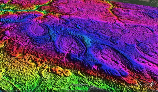
We’ve talked about the Carolina Bays before, but today we’ve got a great new way to view them. Michael at Cintos Research sent over some information about their new use of LiDAR DEM hsv-shaded imagery to expose as many of the Bays as they could — over 22,000 so far!
If you want to just see one quickly, here’s a KMZ file to download. To see the rest of them, you can pull individual KMZ files from this Google Fusion Table that they’ve put together.
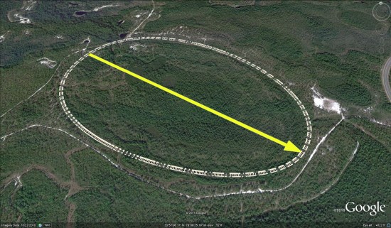
To take it even further, their data includes placemarks for each of the 22,000 bays, with transparent png overlays to show the exact location of each Bay. Turning the overlays on and off help to reveal the bay in the standard Google Earth imagery.
For more about this project, check out the entry at IdeaScale.com.