Last April we showed you a variety of imagery and tools related to the Eyjafjallajokull volcano eruption in Iceland, as it caused some major travel delays across the globe.
This year, the nearby Grimsvotn volcano is the one erupting and causing issues, though it’s on a much smaller scale than Eyjafajallajokull’s was. To show the extent of the ash cloud from Grimsvotn, Adam Burt has built a very cool visualization in Google Earth.
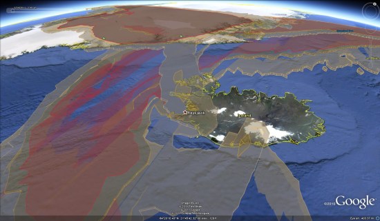
Not only is it a great visualization, but it has a few extra dimensions that you wouldn’t expect; elevation and time. You can fly through the visualization to see how the ash spreads differently at different elevations, and you can also animate the entire cloud to see it in motion.
To try it for yourself, simply download this KMZ file. For more, check out the post over on Ogle Earth.