Over the years, we’ve covered a few Civil War related projects, such as the Pennsylvania Civil War Trails, but there really haven’t been too many that have caught our attention. Darian Robbins is changing that.
His blog showcases a variety of 3D models from civil war times (including many buildings which are still around today), but his latest piece is something to see — the Battle of Fort Sumter.
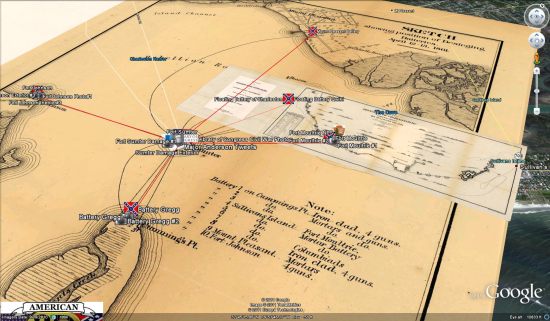
The KMZ file , which can be found in the 3D Warehouse, contains a ton of information including:
- 3D version of Fort Sumter before it was attacked.
- 3D version of the Floating Battery of Charleston that was used to fire on Fort Sumter.
- Historical map overlays of the locations of various Confederate Batteries that fired on Fort Sumter.
- Geo-located Civil War Era photos of the damage Fort Sumter endured and the locations of the Confederate batteries.
- Twitter Feeds of the Washington Post’s twitter campaign of the Civil War.
- Links to Qwiki and Wikipedia articles and media about the Battle and various locations.
His inspiration for this model was the commemoration of the 150th anniversary of the Battle, which took place April 12-13, 1861.