Garmin Heads Back To Hawaii

On Sunday, July 31, 2011, the eyes of the ocean community will be on more than 250 athletes on both prone and stand-up paddle boards (SUP) who will attempt the 32-mile, open-ocean crossing of the infamous Ka’iwi (kah-EE-vee) Channel, also known as the Molokai Channel during the Paddle Board World Championships in Hawaii. And Garmin is thrilled to yet again be a sponsor of this prestigious race and involved within this tradition rich community.

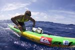
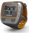
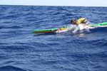
Vying for his 10th consecutive World Championship title, Garmin sponsored athlete Jamie Mitchell will have a target on his back as he crosses the potentially dangerous Molokai Channel. Mitchell practices prone paddle boarding, which is one of the toughest, mentally grueling and most ocean-sensitive paddle sports in which one uses their arms as the paddles while either laying down or positioned on their knees. Mitchell will need to recognize each change in the ocean landscape, as any minor ocean change, such as a knot of wind, inch of tide or ripple of surf could affect his performance drastically. Mitchell will have his trusted Forerunner 310xt attached to his board giving him speed and  distance metrics as well as directional guidance during this marathon paddling event.
Marine Day With Shinkai

The ocean covers approximately 70 percent of the Earth’s surface and yet remains one of the most mysterious places on the planet. In Japan, bodies of water with depths over 200m (656 feet) are referred to as shinkai, or deep sea. These dark regions of the ocean do not receive light and water pressure is up to 100x higher than at the surface, making the shinkai inaccessible to most exploration.

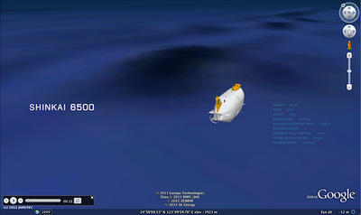
In honor of Marine Day in Japan, we collaborated with JAMSTEC (Japan Agency for Marine-Earth Science and Technology) and the manned Shinkai 6500 submarine to share this hidden world through Google Earth. Dive beneath the surface to explore the shinkai, as well as shipwrecks, research discoveries, surf spots and more.

The Shinkai 6500 is able to dive to depths of 6,500m (21,325 feet), a feat few other vessels can match. It is equipped with a variety of research devices such as search lights, cameras and robotic arms. A cockpit enables three pilots to withstand the extreme conditions and even includes a spyglass for visual exploration of the deepest parts of the ocean.


Shinkai 6500’s mission is to bring the secrets of the deep sea to the surface for marine enthusiasts. It studies movement of the Earth’s interior, living organisms equipped to survive the most extreme conditions and the impact of hydrothermal activity on the environment.

In order to bring this research to life, we worked with JAMSTEC to create a Google Earth tour showcasing past Shinkai 6500 endeavors to the ocean floor. Join the crew by downloading the KML file (in English or Japanese) and opening in Google Earth.

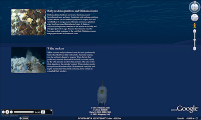
The Shinkai 6500 tour highlights previous deep sea missions and marine life.

As the submarine descends, you will learn more about the vessel and the creatures it finds in the deepest parts of the ocean, including historical imagery from past ventures. Discover unique deep sea features and lifeforms – from rare translucent fish such as the Liparis to hydrothermal vents known as white smokers.

Learn more about life at the bottom of the sea as the Shinkai 6500 explores the Google Earth ocean.

We hope the Shinkai 6500 inspires you to continue to explore the deep sea and its hidden treasures. We recommend starting with the ocean seafloor tour or deep sea vents ridge 2000. You can find even more ocean tours in the Ocean Showcase on the Google Earth website.


The Geo Teachers Institute

For years, Google’s geo products have been identified as a powerful learning toolkit that can help students conceptualize, visualize, share, and communicate information about the world around them.

This fall, we will host two Google Geo Teachers Institutes: September 23 and 24, 2011 in Washington DC at National Geographic Headquarters and September 26 and 27, 2011 at the University of Southern Maine Lewiston-Auburn College in Lewiston, Maine.

This event is a free professional development experience designed to help educators get the most from Google’s geo products and technologies. The Geo Teachers Institute is an intensive, two-day event where participants get hands-on experience using Google Earth, Google Maps, and Google SketchUp, including a focus on features like Ocean, Mars, Moon and Sky in Google Earth.

Attendees will learn about innovative instructional strategies and receive resources to share with colleagues. The Google Geo Education team hopes this event will empower educators to bring the world’s geographic information to students in a compelling, fresh, and fun way.

If you are interested, please complete this application. You will be notified if you are selected by August 15, 2011. Even if you can’t make it to this event, we have many online resources available for Google Earth and SketchUp and encourage you to check them out.