Garmin’s newest marine-friendly handheld GPSMAP 78sc

Scott Tunage, host of the award-winning series G3 Sportsman, takes to the woods and waters each week in search of new outdoor adventures. Scott is dedicated to the everyday outdoorsman, and brings a realistic look at what happens in the real world of outdoor adventures – including gear reviews. In the clip below, Scott spends time with Garmin’s newest marine-friendly handheld, the GPSMAP 78sc. The rugged GPSMAP 78sc comes preloaded with U.S. coastal charts and features a 3-axis compass, barometric altimeter, a high-sensitivity receiver, and – like you’ll see in the video – it floats! Watch the video below for a look at why anavid outsdoorsman like Scott doesn’t venture far without hisGPSMAP 78sc. Here’s a hint: “It’s as handy as a pocket on a shirt!”
The discovery of Machu Picchu

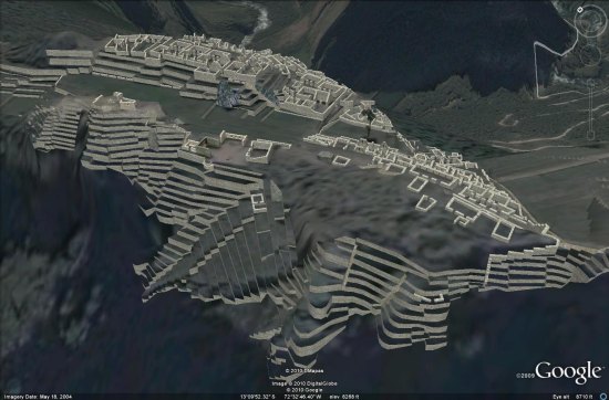
This Sunday, July 24, Peru is celerating the 100th anniversary of the Discovery of Machu Picchu, the Inca city declared one of the new seven wonders of the world and a UNESCO World Heritage Site.

The site was beautifully modeled in 3D by Peter Olsen.

machu-picchu.jpg

To go along with the awesome 3D model, there are a variety of other sites that show off the area in amazing 3D. While this site is in Romanian, you can work your way through it using the arrows at the bottom of the screen and clicking on various parts of the complex.

More impressive is the Quest3D model of the site, though you need to install a special program to make it work which will probably turn quite a few people off.

Ultimately, Peter’s Google Earth model is still the best way to see how amazing Machu Picchu really is. You can fly to it using this KML file, or watch the video below for a quick look at what Peter constructed.

Google Earth: Amsterdam in 3D

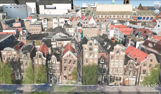
Google has just pushed out thousands of new 3D buildings in Amsterdam, making for quite a remarkable-looking city. What I’ve found especially noteworthy is the level of architectural detail on the smaller buildings in the city. The texture quality on them isn’t great, but the rooflines, chimneys and other aspects of the buildings are quite good.

amsterdam-smaller-buildings.jpg

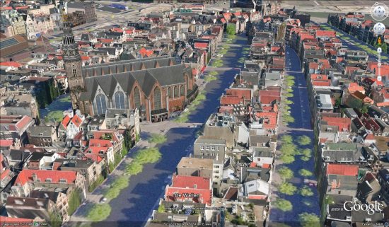
The other thing missing is the trees. I know that most cities around the world still don’t have 3D trees introduced in Google Earth 6, but it would be a major improvement on some of the tree-lined streets, such as the one seen here:

amsterdam.jpg

All of that being said, the city looks great! Google is continuing to expand their 3D coverage, making Google Earth more and more like what you’d find in real life.

You can fly there and check it out in Google Earth by using this KML file, or watch the video below for a fly-through of the city.