CyberCity3D has been doing a lot of cool stuff with Google Earth lately. Last year we showed you their Hidden Treasures of Los Angeles map, and a few months ago they showed off some of their new GeoGames that provide an interactive experience for the user.
Their latest announcement is going back to their roots — 3D modeling. They’ve announced today that they’ve developed a system to produce 3D buildings from stereo satellite imagery, in a way that be scaled to a fairly large region.
As an example, here is a photo of their model of JFK International Airport, which you’ll see includes some rather detailed architecture.
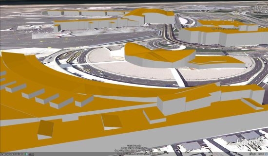
The only real downside to this is that their system doesn’t yet put textured images on the buildings. Hopefully that is something they can figure out in the future. If you’d like to see their model of the airport yourself, you can download this KMZ file .
.
CyberCity3D has created hundreds of thousands of 3D buildings for Google Earth, and this technique may help increase the speed of that. If that can figure out a way to automatically texture the building, or least give users an easy way to texture it themselves, we could see substantial increase in 3D building coverage over the next year.