Google Earth: Le Tour de France

The 2011 Tour de France has recently gotten underway, and Cycling the Alps has built some fun tools to help you see the conditions that the riders are up against.

We’ve shown you some of their work in the past, such as the great games that they added to the site earlier this year. Now they’ve combined that technology with the Tour de France and the result is quite cool.
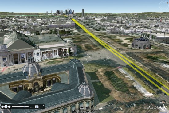
paris.jpg

They’ve gone through and created 3D tours, Streetview tours, profiles and games for every leg of the race. It’s quite an impressive list. Here are a few of the highlights to look for:

Stage 8

There are two stages in the Massif Central which are going to be very challenging, including the last two climbs in this stage: Col de la croix Saint Robert and Super-Besse Sancy.

Stage 12

In the Pyrenees and the climbs of this stage are epic. The Tourmalet is the most famous one but Luz-Ardiden gets a lot of attention in the media as well.

Stage 14

Stage 14 in the Pyrenees is probably the most difficult stage in the race, with six significant climbs.

Stage 18

This years tour is celebrating 100 years of high mountain stages, and every race featured a climb of the Col du Galibier. This year they’ll be climbing the pass two times; once from each side. In stage 18 they will even finish on the Galibier. This is the highest stage finish in the history of the Tour de France.

Stage 19

The next day they will climb the Col du Galibier from the other side, and all three climbs on the 19th stage are legendary.

There’s an amazing amount of info on this site about the Tour, and the games make it fun to ride around on each stage. Congrats to the CTA team for putting this all together.
Mini on Google Maps

Mini Maps on Facebook


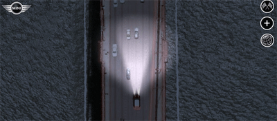
Mini Maps is a great driving game for Facebook that lets you race anywhere in the world on Google Maps.

You can race on tracks created by other players, competing against the best track times or even race against others by inviting your Facebook friends to play. Alternatively you can create your own tracks, set the best time and challenge others to try and beat you.

The game has some great features. Visibility is affected by the local time, so, for example, if you log into San Francisco at night, you are going to be driving with the assistance of your headlamps.

Unlike most Google Maps based driving games this one actually features collision detection. There’s no off road driving here – you will have to stick to those roads. The game also lets you select from a number of Mini models and even lets you customise the look of your car.

Trading With Google Maps


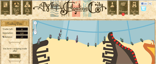
A Map of the Floating City is an interesting looking new game that has created its own game world with the help of Google Maps.

You can sign up for the game with Twitter or Facebook and you are then given your own ship, which will magically appear on the Google Map. The main objective of the the game is to trade with other players in order to move your ship forward on the map.

When you have a trade accepted you get to move your trading partner north on the map. If you accept a trade from another player then your ship gets to move.

This game does require a little patience. The game requires responses from other players so it is obviously never going to be an all out action game. You’ll need to make your trade offers and then come back later to see if they have been accepted.

A Map of the Floating City