When I was in elementary school, I got two days off every February; one for George Washington and another for Abraham Lincoln. I remember classrooms were usually wallpapered with a potpourri of decorations left over from Valentine’s Day and token silhouettes of these two Presidents thumb-tacked to the bulletin board. My teachers would talk about the significance of the holiday during class but with lack of visuals to pique my interest, it was always hard to retain (and fully enjoy!) the information. With that in mind, we’re pleased to celebrate the President’s Day holiday in the U.S. by letting you go back in time to learn more about our past presidents in a visually fun and interactive way.
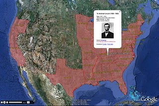
We’ve created a U.S. Presidents Showcase to map the birthplaces of all 44 presidents, and provide details about their presidential terms, using the Google Earth plug-in. You can also see the states that voted during each president’s election by clicking on the tours in the left column of the showcase.

Whether you’re a history buff or simply curious to learn more about U.S. presidents, we hope you enjoy exploring a little further using Google Earth. In addition to the U.S. Presidents map, educators can use some of our other resources in their classroom to explore more aspects of history. Here are a few ideas:
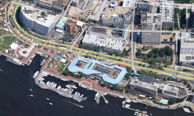
- Explore the White House, Washington Monument, Lincoln Memorial and other historical monuments in 3D and have students explain how architecture is used to honor people, concepts and establishments
- View a 3D model of Valley Forge National Park in Google Earth
- View a copy of the Emancipation Proclamation signed by Abraham Lincoln and map the areas where slavery ended, as well as the areas that were not initially covered by this executive order
- Discuss the famous painting “Washington Crossing the Delaware” by German American artist Emanuel Gottlieb Leutze and use the ruler tool in Google Earth to measure the width of the Delaware River
We hope you have fun exploring and learning a little more of the history behind the President’s Day holiday. And when you’re done, go out and enjoy your day off!
