Thanks to sharp-eyed GEB reader ‘Jorge’, we see that Google has just released some fresh imagery into Google Earth!
As is usually the case, you can use Google Maps to determine for sure whether or not a specific area is fresh. This new imagery isn’t in Google Maps yet, so you can compare Earth vs. Maps to see what’s new; the fresh imagery is already in Google Earth, but the old imagery is still in Google Maps. If you compare the two side-by-side and they’re not identical, that means that you’ve found a freshly updated area in Google Earth!
[UPDATED – 14-June, 11:35am EST]
- Cambodia: Various areas — thanks ‘Rob’
- North Korea: Pyonyang — thanks ‘junjun’
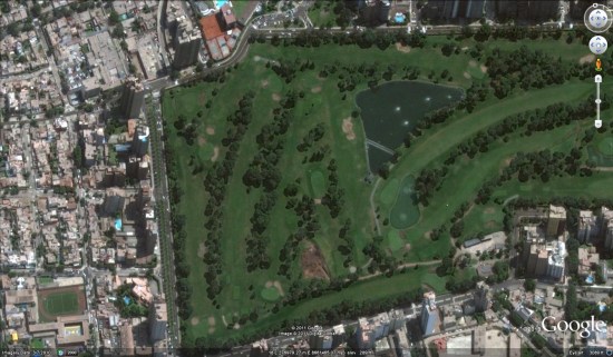
- Peru: Lima — thanks ‘Jorge’
- Romania: Small area near Sfantu Gheorghe — thanks ‘Popescu’
 National Geographic’s world atlases go in a different direction than other world atlases on the market. Instead of a relief map palette that is found virtually everywhere else, National Geographic maps are both minimalist and, for the most part, political: land is white except for coloured country outlines. (They’re also the most obvious example of the