The Street View on Russia

Welcome to Russia! You can now virtually travel through the world’s largest country to the cities of Moscow and St. Petersburg using Google Maps Street View.

Take an online stroll around famous Red Square and Moscow Kremlin, or go to outskirts of Moscow to wander around the beautiful Tsaritsino or Kuskovo parks. You can also visit the former site of the palace in Kolomenskoye, once considered the 8th World Wonder.


Red Square, Moscow


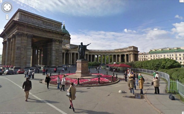
St. Petersburg, the second largest city in Russia and northernmost megapolis in the world, was once a country capital, and the history of this young city started with The Peter and Paul Fortress. Today, the entire historical center of St. Petersburg is a UNESCO Heritage Site that you can enjoy via Street View.


Historical Center, St. Petersburg


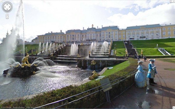
Within St. Petersburg, you can see the great palaces and parks that Russian emperors and nobles built, with Peterhof being its crown jewel. In fact, whole southern shore on the Gulf of Finland consists of palaces and parks including Peterhof, the Oranienbaum, and Alexandria.


Peterhof, St. Petersburg

We hope you enjoy your virtual trip to Russia, and look forward to sharing more countries, cultures and sites as Street View continues to expand to more places. For a demo on how Street View works, start here.

Also, if you have a story to share about a place in Russia, find it in Street View and share it on Google+ with the #streetview.

3D buildings in Google Maps for Android arise in London, Paris, Barcelona, and more

Last December, the release of Google Maps 5.0 for Android ushered in the next-generation of mobile maps where you can rotate, tilt, and zoom in and out of 3D maps. Whether you’re on the go or playing with a new phone, seeing a 3D skyline spring up in New York City, Zurich, Milan, and other cities is a helpful, fun, and unique experience–an experience we want as many of you as we can to have for your city.

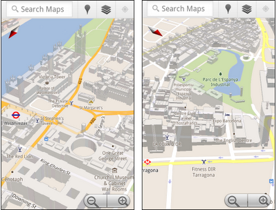
We’ve been adding more cities and you will now find that 3D buildings are available in London, Paris, Barcelona, Stockholm, Singapore, Lisbon, Boulder, and 11 major cities in South Africa

3D buildings in London and Barcelona
You don’t need to update the app, just open Google Maps for mobile on your phone with Android 2.0+ and zoom in to a city with 3D buildings.

Google Earth: World cities at night from space

NASA astronauts have taken photographs of various cities in the world, on the night of Space Shuttle. These images are a great way to visualize the growth of cities and transport networks of cities. They also give some idea of ​​how cities in different countries to develop. In some cities are built on good bars, others have a central core? Without a few rings of transport, and some appear to be completely disorganized.
NASA has collected sketch map of some of these images and descriptions of how they had seized. Many other similar images can be found by searching the gateway to Astronaut Photography of Earth. I took a few pictures and import them overlay in Google Earth. The picture quality is good but not great as it looks, how astronauts use the camera out ready for this.
Following cities are included in this collection. If you find any other good night images of NASA image archives, leave comments, and I will try to add it.

Beijing, China    Buenos Aires, Argentina    Chicago, USA    Denver, USA    Las Vegas, USA    London, England    Long Beach, USA    Los Angeles, USA    Mecca, Saudi Arabia    Montreal, Canada    San – Paulo, Brazil    Seoul, South Korea


Download .KML file