Public Transport Map with Openptmap

Openptmap shows public transport lines. Depending on the zoom level, bus and tram lines are displayed in addition to the railway lines….

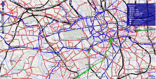
OpenPT Maps – London, UK with All available Public Transport Data overlaid.
Existing Features:
  • Interactive Timetable function (timetables cover Europe)
  • Zoom levels 4 – 17 (Large Scale Zooms)
  • Line numbers

However, there are some useful new features also:

  • Public transport network grid without background available
  • Optional backgrounds: Mapnik and CycleMap
  • Different background luminance (pale modes)
  • Railway timetable on demand with mouse click (small squares)
  • Aerial lifts are displayed

Openptmap editors can be useful in these situations:

  • You added a new pt line to OSM and want to review it
  • You want to get an overview of the Public Transport network without interfering background
  • To find out the departure times of buses/trains at nearby stations
Samsung Galaxy Nexus and Google Earth

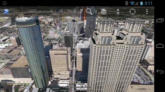
Back in May, Google Earth for Android was updated with 3D building support on tablets. Despite the additional load of the 3D buildings, the software continued to run remarkably smoothly and continues to be an amazing way to view Google Earth.

At the time, the 3D buildings didn’t show up on phones; it wasn’t even an option. However, on the Galaxy Nexus the 3D buildings are in there and they look great!

3d-buildings.jpg

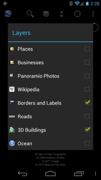
There was no update to Google Earth recently, and the buildings still aren’t available on my old phone (a Motorola Droid X), so presumably Google Earth looks at the hardware on your phone before presenting you with that option. If so, that seems like a wise move. Here is what the options panel looks like on the Galaxy Nexus:

settings.jpg

I don’t know what the minimal specs are offhand, but a dual-core processor seems like a good place to start. The Google Earth page in the Android market simply says “select phones”, so I don’t have a full list of compatible phones yet. As another added bonus, Google Earth came preinstalled on the phone; I’m quite sure that was not the case on the Droid X.

With the large, stunningly high screen resolution on the Galaxy Nexus (1280×720), Google Earth looks simply brilliant. More phones of this quality and beyond will be coming in 2012, which will make the mobile Google Earth experience even better.

The magic of gzip compression

All developers agree that saving bandwidth is a critical factor for the success of a mobile application. Less data usage means faster response times and also lower costs for the users as the vast majority of mobile data plans are limited or billed on a per-usage basis.

When using any of the Google Data APIs in your application, you can reduce the amount of data to be transferred by requesting gzip-encoded responses. On average, the size of a page of users returned by the Provisioning API (100 accounts) is about 100 Kb, while the same data, gzip-encoded, is about 5 Kb — 20 times smaller! When you can reduce data sizes at this dramatic scale, the benefits of compression will often outweigh any costs in client-side processing for decompression.

Enabling gzip-encoding in your application requires two steps. You have to edit the User-Agent

string to contain the value gzip

and you must also include an Accept-Encoding

header with the same value. For example:

User-Agent: my application - gzip

Accept-Encoding: gzip

Client libraries for the various supported programming languages make enabling gzip-encoded responses even easier. For instance, in the .NET client library it is as easy as setting the boolean UseGZip flag of the RequestFactory object:

service.RequestFactory.UseGZip = true;

For any questions, please get in touch with us in the respective forum for the API you’re using.