Google Map Maker USA Launches
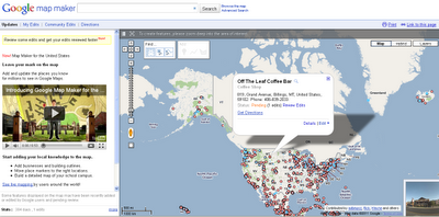
Start adding your local knowledge to the map.
- Add businesses and building outlines.
- Move place markers to the right locations.
- Build a detailed map of your school campus.
(note: Open Street Map does have a service with one major benefit over Google Map Maker – data you create (with many thousands of others) is available to everyone for free even if commercial organization.
Google Maps retains this information only limited places have MapMaker Downloads
http://www.google.com/support/mapmaker/bin/answer.py?hl=en&answer=156852
but read the terms… first.
8.1
You Must Be a Non-Profit Entity, a Government Agency, or an Individual. You must be a non-profit entity, a government agency, or an individual acting on a not-for-profit basis. For-profit entities and individuals acting on a for-profit basis are not permitted to use the Map Maker Source Data, but may be eligible to use Google’s other geo-related products, such as the Google Maps APIs, according to the terms of service for those products.
8.2 Your Map Project Must Be Non-Commercial and Free of Charge to Users.
(a) Your Map Project must be for non-commercial uses only. You cannot use Your Map Project to either directly or indirectly generate revenue as part of a for-profit enterprise. For example, Your Map Project cannot be hosted on the website of a for-profit company. However, Your Map Project can be hosted on the website of a validly-registered non-profit or governmental entity (as determined by the applicable law of your jurisdiction).
(b) Your Map Project must be free of charge. You may require users to log in to Your Map Project but you cannot require users to pay a fee (unless you have entered into a separate written agreement with Google or obtained Google’s written permission to do so).
8.3 Your Map Project Must Provide Google with Attribution. Unless otherwise agreed to by Google in a written amendment to these Terms, in every instance in which the Map Maker Source Data are used in Your Map Project, Your Map Project must include the following attribution notice in accordance with the requirements below:
(a) Text of Notice: “Map Data © 2009 Google – Improve with Google Map Maker“.

Live (real-time) updates of edits to google map maker service – http://www.google.com/mapmaker/pulse
YouTube Video the USA MapMaker
source:
http://google-latlong.blogspot.com/2011/04/add-your-local-knowledge-to-map-with.html


