OziExplorer GPS mapping real time tracking software for Android Devices

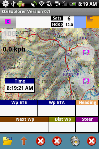
OziExplorer for Android is moving map software for devices running the ANDROID O/S. It uses raster map images which are either scanned or purchased in digital format. It allows you to track your position received from the GPS on a map (moving map).

OziExplorer for Android is not automatic route planning software, you cannot request the best way to get from point A to point B, the types of maps OziExplorer for Android uses do not allow this.


OziExplorer runs on Android devices but it relies on map calibrations etc to be provided by the full PC version of OziExplorer, you also need the full OziExplorer to calibrate maps, plan trips by adding waypoints etc.

The unlicensed OziExplorer for Android will work with the unlicensed OziExplorer but the limitations of both packages will apply.

Main Features

  • Moving map navigation using the internal GPS.
  • Course Up Mode.
  • 3D Perspective View Mode.
  • Uses almost any map which can be created by the PC version of OziExplorer.
  • Use our Img2ozf utility to convert maps to OZFX3 format.
  • OZF2, OZFX3, ECW, JP2 (jpeg 2000) directly supported.
  • PNG, JPG directly supported (small maps less than 20MBytes uncompressed).
  • Automatic loading of the next map.
  • Check for more detailed map at a set interval.
  • User tracks can be loaded
  • Logging of Track points to file.
  • Create Waypoints at current position by pressing the Create Wp screen button.
  • Many Map Zoom levels.
  • Various Position display formats.
  • On screen display of Speed, Bearing and Altitude.
  • Display Waypoints on the map.
  • Satellite View showing SNR, number of Sats and HDOP.
  • + many more features to be added in future versions.
Devices Supported:
OziExplorer Android will run on smartphones and tablets which run the Android O/S.
  • Android 1.5 (tested and runs but may not be fully supported)
  • Android  1.6 / 2.0 / 2.1 / 2.2 / 3+ supported.
  • Portrait and Landscape is supported.
  • All screen resolutions are supported.

Note – No useable maps are provided with OziExplorer for Android, only example maps.


The software is tested on the following devices:

HTC G1 – Android 1.5 (192MB ram) (320 x 480 screen) (may have memory limitations)

HTC Hero – Android 2.1 (288MB ram) (320 x 480 screen)

Superpad 2 / Flytouch 3 – Android 2.2 (512MB ram) (1024 x 600 screen)

Download OziExplorer Software for Android
Google Map Maker USA

Google Map Maker USA Launches

Google Map Maker USA Launches

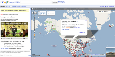
Start adding your local knowledge to the map.

  • Add businesses and building outlines.
  • Move place markers to the right locations.
  • Build a detailed map of your school campus.

(note: Open Street Map does have a service with one major benefit over Google Map Maker – data you create (with many thousands of others) is available to everyone for free even if commercial organization.

Google Maps retains this information only limited places have MapMaker Downloads
http://www.google.com/support/mapmaker/bin/answer.py?hl=en&answer=156852

but read the terms… first.

8.1
You Must Be a Non-Profit Entity, a Government Agency, or an Individual. You must be a non-profit entity, a government agency, or an individual acting on a not-for-profit basis. For-profit entities and individuals acting on a for-profit basis are not permitted to use the Map Maker Source Data, but may be eligible to use Google’s other geo-related products, such as the Google Maps APIs, according to the terms of service for those products.

8.2 Your Map Project Must Be Non-Commercial and Free of Charge to Users.

(a) Your Map Project must be for non-commercial uses only. You cannot use Your Map Project to either directly or indirectly generate revenue as part of a for-profit enterprise. For example, Your Map Project cannot be hosted on the website of a for-profit company. However, Your Map Project can be hosted on the website of a validly-registered non-profit or governmental entity (as determined by the applicable law of your jurisdiction).

(b) Your Map Project must be free of charge. You may require users to log in to Your Map Project but you cannot require users to pay a fee (unless you have entered into a separate written agreement with Google or obtained Google’s written permission to do so).

8.3 Your Map Project Must Provide Google with Attribution. Unless otherwise agreed to by Google in a written amendment to these Terms, in every instance in which the Map Maker Source Data are used in Your Map Project, Your Map Project must include the following attribution notice in accordance with the requirements below:

(a) Text of Notice: “Map Data © 2009 Google – Improve with Google Map Maker“.

Google Map Maker Pulse
Live (real-time) updates of edits to google map maker service – http://www.google.com/mapmaker/pulse


YouTube Video the USA MapMaker

source:
http://google-latlong.blogspot.com/2011/04/add-your-local-knowledge-to-map-with.html

New Code Sample & Map App: Washington Real-time Transit

00_logoReal-time bus schedules takes the uncertainty out of riding the bus. Sometimes a bus arrives early and you have to choose whether to chase after it or wait for the next one. Other times the bus arrives late and you have to wait at the bus stop, looking down the road wondering when the bus will appear. If the weather is bad or you’re alone at the bus stop in the dark, you need to know exactly when your bus is coming – at the very least for peace of mind.

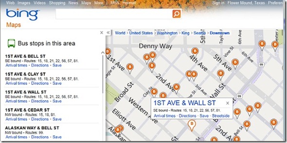
The Washington real-time transit map app brings real-time bus schedules (provided by OneBusAway) to Bing Maps for the Puget Sound / Seattle area. The map app was developed by Luan Nguyen, who wrote an article for MSDN in October on how to add real-time transit data to a map app. His article goes into how to access the OneBusAway API, defining the map entity, writing the main plug-in, and displaying the content. He also goes in-depth into the code, which is now freely available.

When you first open the map app, you’re shown the transit agencies with available data. I recommend using the Bing search bar or map control to zoom in to your location rather as the “go to this area” links keep you at a fairly high level.

Bing Maps real time transit map app