A couple of days ago we showed you the location of the Morganza Spillway and the expected flood area, and now some fresh satellite imagery is coming in to show what’s actually been happening.
The imagery comes via GeoEye, and covers various parts of the Mississippi River from Illinois down to Louisiana. You can view all of the imagery using this KML file that Google unveiled last night.
For more, you can check out some additional imagery that was captured on Sunday and shown on the NASA Earth Observatory site, or see it in Google Earth with this KML file (note — it’s a 4MB image, so it make take a few seconds to load).
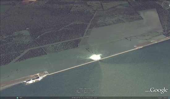
The white area next to the spillway is whitewater being churned up by the fierce flow of water, and you can clearly see fields and other nearby areas that have been flooded. I expect we’ll see more imagery from this area in the coming weeks as the water continues to rise.