Garmin’s multi-sensor controller concept for infotainment systems helps reduce driver distraction


Garmin Multi-Sensor Controller Concept_Close-up

With the increasing use of technology and smartphones behind the wheel, driver distraction has become a concern. But technology in general is not the problem. The most important question is how it is being used and integrated into the car so that it doesn’t distract drivers. Garmin’s new multi-controller concept provides a new and unique way of controlling essential functions of an in-car infotainment system, such as audio, apps, communications and navigation. It is a concept development from Garmin’s automotive OEM group, providing further research for enhanced reduction in driver distraction.

Garmin Infotainment Multi-Controller Concept Audio Low Res

Garmin’s concept positions the screen higher up on the dash inthe driver’s eyesight and combines it
with a rotary infrared controller in convenient reach, a touch pad, and menu mode buttons. The infrared sensors of the rotary controller automatically detect an approaching hand and the system reacts by displaying menu options even before it is touched. Because the system “knows” when a user is reaching for the controller, menu buttons on the screen are hidden when not needed. At all times important information, such as driving directions and the name of a song or radio station is kept at the top of the screen so the driver always has a single reference point. Four buttons with infrared sensors on the rotary controller allow switching between different menus, such as audio, apps, communications and navigation.

In addition to the rotary controller, radio preset buttons with infrared sensors are positioned below the screen to allow a driver to feel for the right button without having to press it – when their finger is close to a preset button, a highlighted preset image appears on the display, allowing the driver to select a station.

Tied into this system can be HVAC controls, vehicle bus information, connected services and apps from a smartphone. Existing technology like text-to-speech, voice command, Bluetooth hands-free calling and traffic services also helps alleviate driver distraction to avoid potentially dangerous situations.

Garmin’s automotive OEM group utilizes the company’s long-standing experience in interface and hardware design from its automotive, avionics and marine segments to develop innovative in-car navigation, telematics and infotainment systems. Garmin already provides integrated cockpits to the aviation industry and is dedicated to bring a similar level of technology, integration, safety, reliability, and efficiency to the automotive market. Garmin recently announced its first fully integrated infotainment system for most 2013 Suzuki vehicles.
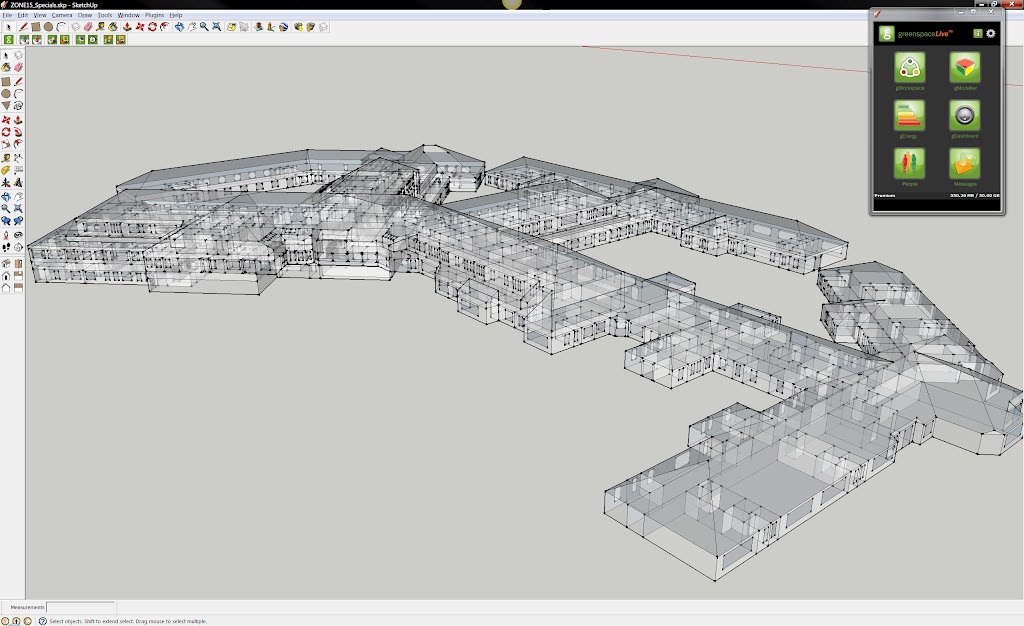


SketchUp: NHS Western Isles Hospital


GreenspaceLive is a software and consultancy shop based on the Isle of Lewis in Scotland. The company was founded in 2008 as a spin-out from the Greenspace Research, a low-carbon building and renewable energy research program at Lews Castle College, University of the Highlands and Islands. This case study about gModeller, the company’s SketchUp energy analysis plugin based on gbXML, comes to us from Donald Macaskill, Technical Manager and Energy Engineer at GreenspaceLive.

Making hospitals more energy efficient

Hospitals have unique energy consumption demands. Not only do a hospitals require lighting and heating 24 hours a day, but they also require ventilation, sterilization, laundry, food preparation and important medical equipment to be powered as well. Therefore, any improvements made to the building could drastically reduce the bills, freeing up money to be spent elsewhere.

The NHS Western Isles Trust are very proactive in trying to reduce their energy costs and carbon footprint. To determine their baseline energy consumption and carbon emissions and then to simulate a number of fabric and technology improvements to their largest building, they turned to GreenspaceLive. A hospital model and energy analysis workflow was created in Google SketchUp Pro with GreenspaceLive’s gTools suite.


Completed model for gModeller 


Project Methodology

To start, existing 2D CAD models and scanned paper drawings were shared via gWorkspace. These floor plans were then imported into Google SketchUp Pro. Once the floor plans had been imported, each floor was extruded to the correct height and dimensions. A detailed model is not required for the gModeller plugin, so the model could be simplified to single faces for walls, floors and roofs.

Once completed, attributes were added to the model using the gModeller’s customised materials, located within the Paint Bucket tool in SketchUp. Next, spaces were identified using the manual Space tool, which allowed the model to have zone specific information, such as heating, lighting and ventilation for different areas.


The completed gbXmL model 


The gbXML building information model generated by gModeller was now ready to be exported to an energy analysis engine. In this case, gEnergy was used, however, exported models can also be imported into Green Building Studio, Ecotect, Trace, DesignBuilder and others. gEnergy was initially run using the Hospital’s existing fabric and technologies to establish a baseline Energy Performance rating, subsequent analysis runs were then carried out with simulated improvements to the building, including proposed refurbishment changes, to determine the impact they would have on performance of the building.

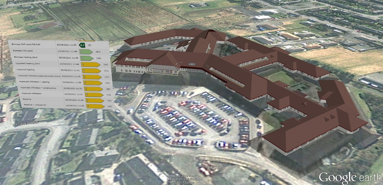
Once gEnergy runs were completed, the model was exported to Google Earth and presented to the clients, showing gDashboard energy results on screen while touring their model.


The model in Google Earth with energy data 


Using the gWorkspace cloud platform, the modeling team was able to share and collaborate with the client throughout the process. Team members and client representatives were able to view, download and share files from the project, as well as view all energy runs that were undertaken.

The Results

Armed with the tools and the data, NHS Western Isles Hospital were able to model different scenarios and view the impact these changes would have. The results were dramatic – making a number of changes to the heating system, the team was able to demonstrate that the most effective change would result in over 50% energy savings, while reducing the CO2 emissions by almost 80%.

Dave Tierney, part of the Energy Team at NHS Western Isles Hospital said, “Using gTools, senior executives and staff received an overview of our carbon emissions, energy consumption and the impact changes in technology and fabric will have on our building. We can clearly see the differences in low carbon technology investment options. The results will help shape our plans for tackling carbon emissions and energy consumption in the future.”

The Google Earth Community


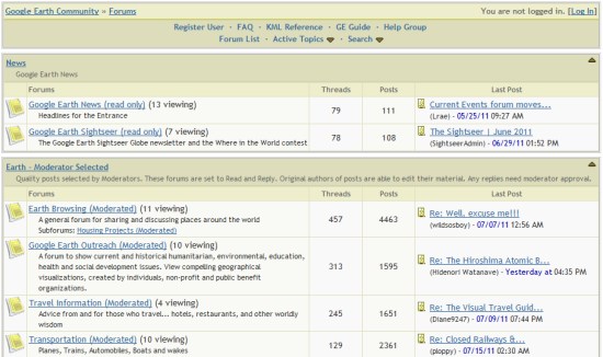
The Google Earth Community, formed in 2002 when Google Earth was still an independent product called “Keyhole”, has been an excellent resource for Google Earth users. Not only was the community a great place to post new files that you create/discover, but you could get answers to almost any Google Earth-related question in there.


bbs.jpg 

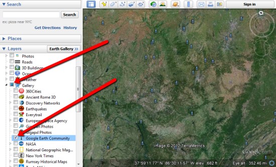
They even added a Google Earth Community layer to Google Earth back in 2005 to show off the great files that users have added, which you can still find under the [Gallery] section of your Layers.


layer.jpg 

Recently, the GEC had had some stability issues. Because it was based off of an older BBS technology, it was having increasing amounts of trouble under an ever-growing load. To fix that, Google is now moving it over to a Google Groups-based system which should help with those issues tremendously.

Right now Google is in the process of moving all of the posts and attachments to the new system. With more than 1.2 million posts on there, it’ll take some time. They’re hoping to have the data ported over by next week, and we’ll certainly let you know when it goes live.

If you have any questions or problems in the meantime, you can use the Google Earth forums already in place in Google Groups

via: GoogleEarthBlog