Timelapse video of Google Map Maker mapping activity in Tbilisi, Georgia.
Timelapse video of Google Map Maker mapping activity in Tbilisi, Georgia.
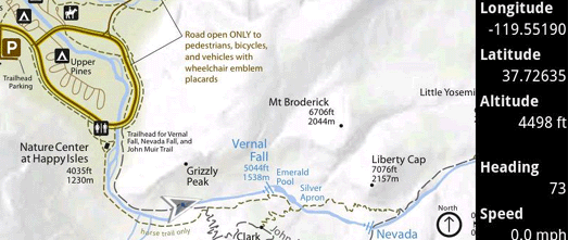
Custom Maps is an essential app for Android phones for any serious off-trail hikers, sailors or anyone else who needs detailed off-line maps.
The app lets you quickly create a custom map for your Android phone from any map image or photo file. The image can be a photo or scan of a paper map. It could even just be the photo of a map posted at the beginning of a trailhead or at the entrance to an amusement park, which you can capture with your smartphone camera.
To create a custom map all you have to do is choose two (or more) points in your map image and plot them on a Google Map. That’s all it takes. Your finished map can then show your GPS location and will work even when a data signal is not available like in a state park or when abroad.
I have a boat that is moored on a river with lots of tributaries and creeks, some of which are navigable and some of which aren’t. When you start exploring these backwaters it is very easy to quickly lose a sense of where you are.
Using Custom Maps I made an off-line map for my phone in less than five minutes using a scan of a river chart. Now I should never get lost on my boat again.
The source code for Custom Maps is also available on Google Code. Several new features are also planned for the app including distance measurement, marking map locations with icons and making it possible to geolocate map images without Google Maps or a data connection.
Via: Open Source at Google
It’s taken 24 centuries, the work of archaeologists, scholars and historians, and the advent of the Internet to make the Dead Sea Scrolls accessible to anyone in the world. Today, as the new year approaches on the Hebrew calendar, we’re celebrating the launch of the Dead Sea Scrolls online; a project of The Israel Museum, Jerusalem powered by Google technology.
Written between the third and first centuries BCE, the Dead Sea Scrolls include the oldest known biblical manuscripts in existence. In 68 BCE, they were hidden in 11 caves in the Judean desert on the shores of the Dead Sea to protect them from the approaching Roman armies. They weren’t discovered again until 1947, when a Bedouin shepherd threw a rock in a cave and realized something was inside. Since 1965, the scrolls have been on exhibit at the Shrine of the Book at The Israel Museum, Jerusalem. Among other topics, the scrolls offer critical insights into life and religion in ancient Jerusalem, including the birth of Christianity.
Now, anyone around the world can view, read and interact with five digitized Dead Sea Scrolls. The high resolution photographs, taken by Ardon Bar-Hama, are up to 1,200 megapixels, almost 200 times more than the average consumer camera, so viewers can see even the most minute details in the parchment. For example, zoom in on the Temple Scroll to get a feel for the animal skin it’s written on—only one-tenth of a millimeter thick.

You can browse the Great Isaiah Scroll, the most well known scroll and the one that can be found in most home bibles, by chapter and verse. You can also click directly on the Hebrew text and get an English translation. While you’re there, leave a comment for others to see.

The scroll text is also discoverable via web search. If you search for phrases from the scrolls, a link to that text within the scroll viewers on the Dead Sea Scrolls collections site may surface in your search results. For example, search for [Dead Sea Scrolls “In the day of thy planting thou didst make it to grow”], and you may see a link to Chapter 17:Verse 11 within the Great Isaiah Scroll.
This partnership with The Israel Museum, Jerusalem is part of our larger effort to bring important cultural and historical collections online. We are thrilled to have been able to help this project through hosting on Google Storage and App Engine, helping design the web experience and making it searchable and accessible to the world. We’ve been involved in similar projects in the past, including the Google Art Project, Yad Vashem Holocaust photo collection