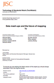
Over the past few months we have been working with colleagues here at CASA, University College London and at the University of Nottingham, in association with the Joint Information Systems Committee (
JISC) to write a report on Data mash-ups and the future of mapping. We are pleased to say the report has just been released and is available to download.
Report by Suchith Anand, Michael Batty, Andrew Crooks, Andrew Hudson-Smith, Mike Jackson, Richard Milton, Jeremy Morley
Data Mash-Ups and the Future of Mapping
Executive Summary
The term ‘mash-up’ refers to websites that weave data from different sources into new Web services. The key to a successful Web service is to gather and use large datasets and harness the scale of the Internet through what is known as network effects. This means that data sources are just as important as the software that ‘mashes’ them, and one of the most profound pieces of data that a user has at any one time is his or her location. In the past this was a somewhat fuzzy concept, perhaps as vague as a verbal reference to being in a particular shop or café or an actual street address. Recent events, however, have changed this. In the 1990s, President Bill Clinton’s policy decision to open up military GPS satellite technology for ‘dual-use’ (military and civilian) resulted in a whole new generation of location-aware devices.Around the same time, cartography and GIScience were also undergoing dramatic, Internet-induced changes.

Traditional, resource intensive processes and established organizations, in both the public and private sectors, were being challenged by new, lightweight methods. The upshot has been that map making, geospatial analysis and related activities are undergoing a process of profound change. New players have entered established markets and disrupted routes to knowledge and, as we have already seen with Web 2.0, newly empowered amateurs are part of these processes. Volunteers are quite literally grabbing a GPS unit and hitting the streets of their local town to help create crowdsourced datasets that are uploaded to both open source and proprietary databases.
The upshot is an evolving landscape which Tim O’Reilly, proponent of Web 2.0 and always ready with a handy moniker, has labelled Where 2.0. Others prefer the GeoWeb, Spatial Data Infrastructure, Location Infrastructure, or perhaps just location based services. Whatever one might call it, there are a number of reasons why its development should be of interest to those in higher and further education. Firstly, since a person’s location is such a profound unit of information and of such value to, for example, the process of targeting advertising, there has been considerable investment in Web 2.0-style services that make use of it. Understanding these developments may provide useful insights for how other forms of data might be used. Secondly, education, particularly research, is beginning to realize the huge potential of the data mash-up concept. As Government, too, begins to get involved, it is likely that education will be expected to take advantage of, and indeed come to relish, the new opportunities for working with data.
This TechWatch report describes the context for the changes that are taking place and explains why the education community needs to understand the issues around how to open up data, how to create mash-ups that do not compromise accuracy and quality and how to deal with issues such as privacy and working with commercial and non-profit third parties. It also shows how data mash-ups in education and research are part of an emerging, richer information environment with greater integration of mobile applications, sensor platforms, e-science, mixed reality, and semantic, machine-computable data and speculates on how this is likely to develop in the future.


