Report Local Problems with Google Maps

Neat Streets

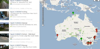
Australian website Neat Streets allows anyone to report community problems which are then passed on to the appropriate authorities. The application works in both Australia and New Zealand.

You can download a Neat Streets application for the iPhone, Blackberry, and Android based phones. With the apps you can take pictures and submit community problems directly from your smartphone. The latest submitted photos and problems are displayed on a Google Map on the Neat Streets website home page.

Using Neat Streets you can report road obstructions, vandalism, potholes, fallen trees, abandoned trolleys, litter, and graffiti. Neat Streets then automatically forwards the reports to the appropriate authority based on the GPS location
More Local Problems with Google Maps

Mark-a-Spot

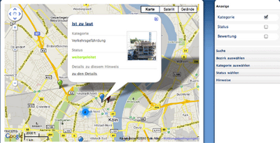
Mark-a-Spot is a web-based platform to display, categorize, comment and rate places in urban environments. It can be used as a participation platform or it can be used to let local citizens report issues, like pot-holes, broken street lighting or lack of accessibility.

The system uses Google Maps to show the location of reported problems. You can see a demo of the system in action at MaS-City. Mark-a-Spot is free for local authorities to implement and licensed under the GNU Affero General Public License.

Scholarly Data, Network Science, and (Google) Maps

Google Tech Talks January 31, 2007 ABSTRACT Want to see science from above? Curious to see what impact one single person or invention can have? Keen to find pockets of innovation

http://www.youtube.com/v/vos5QBDywMM?f=videos&app=youtube_gdata