Google Maps: New Cities in 3D

Google Maps continuously works to bring you real-life 3D representations of your favorite cities from around the world. Google Maps in 3D combines a functional map with stunning visuals. You can tour an increasing number of cities in 3D and experience the streets and sights right from your computer or Android device.

Since embarking on our 3D mapping efforts, we have amassed a collection of cities that allows you to feel like a jet-setter. We have recently expanded and improved this collection to include more cities in Europe and the US, to name a few. You can experience a few cities below.

Hop on your scooter and take a romantic tour through Rome, Italy.

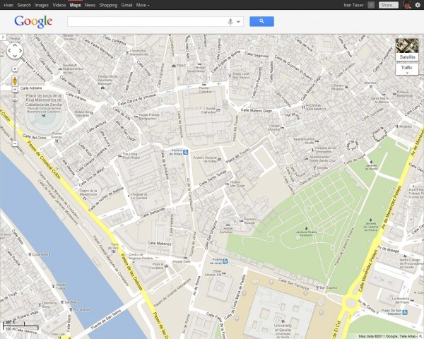
Tour Seville, the artistic, historic, and cultural capital of southern Spain.

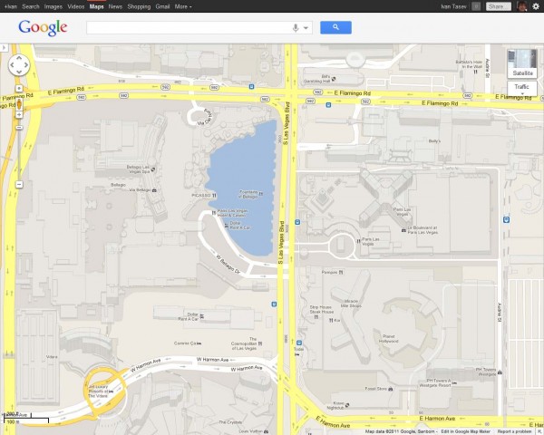
Or take a look at the casino resorts that dot the Las Vegas Strip which has also been updated with 45 degree satellite imagery as well.


New 3D maps coverage is available in:

US: Foster City, Honolulu, Las Vegas, Norfolk,Palo Alto, Portland, Redwood City, Riverside, Salt Lake City, San Antonio, San Diego, Santa Cruz, Sunnyvale.
Europe: Rome, IT, Rotterdam, NL; Seville, ES; Stuttgart, DE, Amsterdam, NL

Street View takes you inside museums around the world

We’re always excited to share new Street View imagery with users, whether a botanical garden in South Africa or ski slopes in Canada. While Street View has enabled users to visit places all around the world virtually, the demand to show a broader range of popular locations has been great. Today we’re entering new territory with our experiment to take Street View technology indoors.
The Art Project, developed by a group of art-loving Googlers, is a collaboration between Google and 17 of the world’s most acclaimed museums. Select works of art chosen by these partners are now available for you to explore through Street View in Google Maps, and the Art Project site offers an immersive experience to explore museum information, floor plans, more than 1000 high-resolution pieces, and Street View imagery. Learn more about the Art Project on the Official Google Blog.
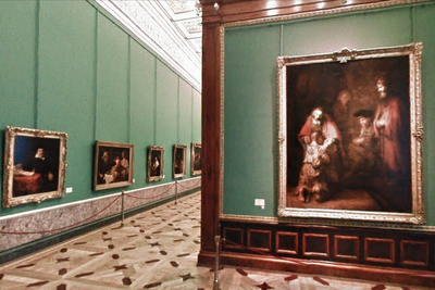
To take you inside magnificent spaces like the State Hermitage Museum in St. Petersburg, Russia, our team needed to update the way we go about gathering Street View images.
The State Hermitage Museum, St. Petersburg, Russia
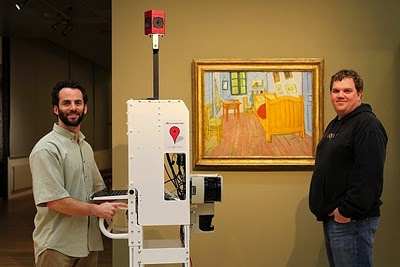
Street View imagery is typically collected using cars and we’re able to utilize the ample roof space and interior storage of these vehicles for all of our equipment. To take Street View technology indoors, we needed to fit all of the equipment on a much smaller vehicle, a push-cart lovingly dubbed Trolley.
Pictured with Trolley: Daniel Ratner, Mechanical Engineer and Matt Williams, Program Manager at the Van Gogh Museum in Amsterdam, The Netherlands
Trolley is outfitted with a few components that are key to collecting indoor imagery: a panoramic camera to collect 360-degree views, lasers to capture distances to walls, motion sensors to track Trolley’s position, a hard drive to store data, and a laptop to operate the system.
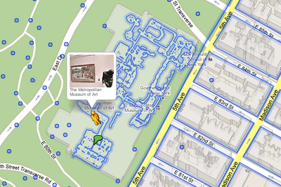
With this adapted equipment, we were able to gather the imagery and bring it into Google Maps, and you can now drag Pegman directly onto museums like the Metropolitan Museum of Art in New York City to explore their impressive European Paintings wing.
The Metropolitan Museum of Art, New York, United States
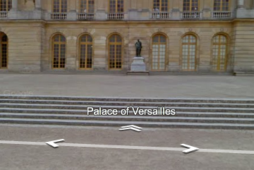
You can also enter museums when you’re already looking at Street View imagery of the museum exterior. You’ll notice new double-arrow navigation links from the nearby streets leading you inside, as you can see here for the Palace of Versailles.
Palace of Versailles, Versailles, France
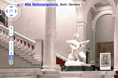
Once inside the museum, you can navigate around rooms freely with the navigation arrows or simply click on a distant spot to jump to a closer view. Movement between floors can also be done with ease by selecting a different level from the new control panel below the Street View compass and zoom controls.
Alte Nationalgalerie, Berlin, Germany
We’re excited to introduce this new imagery in Street View, and will continue to improve and develop this indoor experience. To explore these museums directly through Street View in Google Maps, visit maps.google.com/museums, and to view high-resolution artwork and learn more about the museums, check out the Art Project at www.googleartproject.com.
Clouse Encounters of the Semantic Kind

Explorers are we intrepid and bold
It was bound to happen. Some time ago I got curious about the whole semantic web thing. Working on the geoportal extension at ESRI, we’re looking for ways to improve connecting users with producers of geospatial resources. With the advent of systems of systems (although sometimes feeling like turtles all the way down), assuming that a single catalog will do the trick is not an option. So I embarked on a journey into the world of linked data, RDF, and all the fun that comes with that

Out in the world amongst wonders untold
A couple months ago, I got invited to participate and present in a workshop at WMO about information access enablers. Tim Berners Lee suggested to the organizer to look into the RDF model as a way to allow linking data across organizations.

Equipped with a wit, a map, and a snack
So after seeing data.gov experimenting with SPARQL I felt it time to do some experimenting myself. Got some content from data.gov through the REST interface provided by geodata.gov (all 270,000+ geospatial datasets in data.gov actually are registered in geodata.gov and data.gov reuses this content through a web service. how gov 2.0 is that!), downloaded joseki, generated a Turtle file of the catalog, and had my own SPARQL server up and running. All while flying from Amsterdam to DC on my way from WMO to the Gov 2.0 Expo.

We’re searching for fun, and we’re on the right track
At Gov 2.0 I got a unique chance to sit down with TBL and discuss some of our work. You just don’t pass on an opportunity like that! INFORMATION.ZIP. Later that day TBL met with Jack and it suffices to say that SPARQs flew through the room (pun intended). How to model spatial relations in RDF? How to handle relations that aren’t explicitly expressed but are determined on-the-fly as a result of some question? What does ‘nearby’ actually mean?

Like any meeting with your professor at college, you leave said meeting with more work than you entered… I loaded various w3c documents, RFCs, and more prior to board the airplane for California.We’re just starting to learn the possibilities of RDF, SPARQL. Providing a text box for someone to fill out an obscure query is not enough. But there already are some good examples available, such as the site This We Know.

to be continued…