Spring is in the air and it’s time to put away those jackets, dust off your shorts and get ready to see some sunshine! The Geo Imagery team has been hard at work in our snow covered buildings in Mountain View to get the latest set of imagery ready for everyone to enjoy.
When you think of sunshine, the first place that comes to mind for a lot people is Honolulu HI of course! With 45° in hand, scope out the ocean views from beachside hotels. You can check out Diamondhead, the coastline or the golf courses to reminisce on the vacation you’ve always wanted.
Waikiki, Honolulu, Hawaii
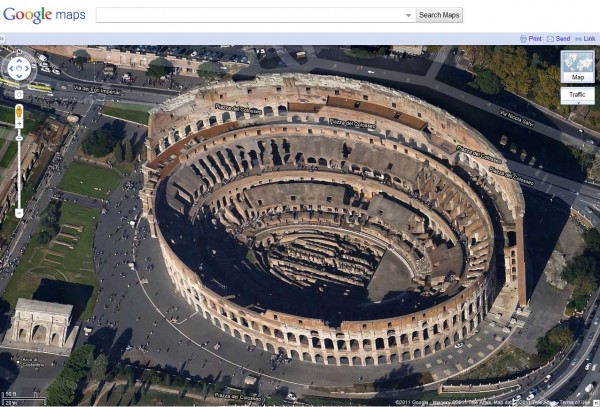
If you’re not the type that likes to watch the sunset while sipping on mai tais, then maybe a nice glass of wine on a piazza in Rome is more up your alley. Visit the Colosseum, Vatican City or Trevi Fountain all from the comfort of your own home. You can plan out your vacation first, then see it in person!
Colosseum, Rome, Italy
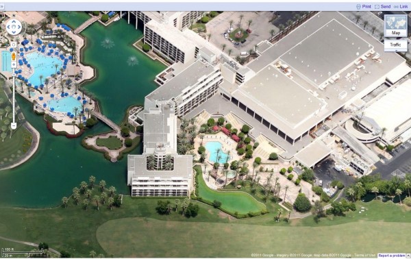
But if your true definition of love is being in the outdoors, by yourself and a set of golf clubs, nothing beats Palm Springs, CA, where there are over 120 golf courses. Believe it or not, Sonny Bono was mayor here from 1988–1992!
Palm Springs, CA
Keep an eye out for future updates, we’re always working hard to make sure our users get the latest and greatest imagery. For our full list of 45° imagery, see where we are in My Maps.
High Resolution Aerial Updates:
St Louis, MO
Honolulu, HI
New Orleans, LA
Rome, Italy
North Austin, TX
West Norfolk, VA
Scottsdale, AZ
San Rafael, CA
Palm Springs, CA
Lake Forest, CA
Boulder City, NV

