Now You Can See the Weather in Google Maps

Whether you’re organizing a trip overseas or a picnic at a local park, knowing the weather forecast is a crucial part of the planning process. Today, we’re adding a weather layer on Google Maps that displays current temps and conditions around the globe, and will hopefully make travel and activity planning easier.

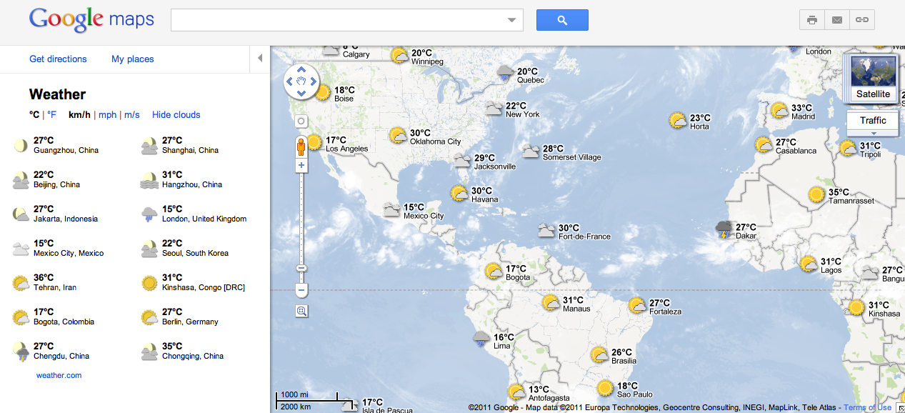
To add the weather layer, hover over the widget in the upper right corner of Google Maps and select the weather layer from the list of options. When zoomed out, you’ll see a map with current weather conditions from U.S. Naval Research Lab. And, if you look closely, you can also tell if it’s day or night around the world by sun and moon icons.

Enabling the weather layer also gives you an instant weather report for friends and family living around the world. For example, it looks like my family in London isn’t experiencing the best summer weather right now:

Weather near London, UK

Clicking on the weather icon for a particular city will open an info window with detailed data like current humidity and wind conditions, as well as a forecast for the next four days. Below is the upcoming forecast for my location in wintertime Sydney, which seems to have the similar weather as London!

Changing the units of wind speed (Mph/KMph) and temperature (F/C), and enabling or disabling the clouds (when you’re zoomed out), can also be done from the left-hand panel.

Weather left hand panel

Get started now and check out the weather layer here.

Traffic information from Google Maps in Sweden and Taiwan

When you turn to Google Maps to get from A to B, we want to help you find the quickest way to get there. Knowledge about the current traffic conditions on the roads can help you determine when to set out on your journeys and which routes to take.

With this in mind, we’ve just expanded our coverage of traffic information on Google Maps to include Sweden and Taiwan. Users in both places can now check the latest on road congestion with their desktop browsers or mobile phones. The traffic information covers all major thoroughfares as well as arterial roads in select cities.

Traffic information around Stockholm, Sweden

When accessing Google Maps, the widget in the upper-right allows you to select additional map layers that display more detailed information. To view traffic information, move your mouse over the widget and select the “Traffic” layer. The colors you see indicate the current traffic speed relative to the speed limit of the road. Red/black means stop start traffic, red is heavy congestion, yellow is a little slow, and green means you’re good to go. This traffic information is updated every few minutes.

While on the go, you can see this same useful information by enabling the traffic layer on Google Maps for mobile, and help improve the traffic data as well. Here’s wishing everyone safe and swift travels!